Back جزيرة بينانق Arabic Pinanq adası Azerbaijani পেনাং দ্বীপ Bengali/Bangla Enez Penang Breton Pulau Pinang (pulo sa Malaysiya, Pulau Pinang) CEB Penango (insulo) Esperanto Isla de Penang Spanish جزیره پنانگ Persian Pulau Pinang Finnish Île de Penang French
Native name: Pulau Pinang | |
|---|---|
 | |
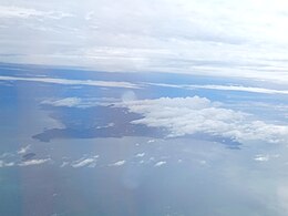
 Penang Island is the main constituent island of Penang | |
| Geography | |
| Location | Strait of Malacca (west) Penang Strait (east) |
| Coordinates | 5°22′N 100°16′E / 5.37°N 100.26°E |
| Archipelago | Malay Archipelago |
| Area | 295 km2 (114 sq mi) |
| Highest point | Penang Hill |
| Administration | |
Malaysia | |
| State | |
| City | |
| Demographics | |
| Population | 794,313 (2020)[1] |
| Pop. density | 2,596/km2 (6724/sq mi) |
Penang Island is the main constituent island of the Malaysian state of Penang. It is located off the western coast of Peninsular Malaysia by the Malacca Strait, with the Penang Strait separating the island from Seberang Perai on the mainland. The 295 km2 (114 sq mi) island makes up approximately 28% of Penang's total land mass and is home to about 45% of the state's population as of 2020[update].[1] The entire island falls under the city of George Town, which also administers the surrounding islets.
- ^ a b "Population and Housing Statistics". Key Findings Population and Housing Census of Malaysia 2020: Pulau Pinang (in Malay and English). Putrajaya: Department of Statistics (Malaysia). 29 May 2022. p. 96. ISBN 9789672535164. Archived from the original on 24 May 2024. Retrieved 13 November 2023.