Back Пенмайнмаур Bulgarian Penmaenmawr Breton Penmaenmawr CEB Penmaenmawr Welsh Penmaenmawr German Penmaenmawr Spanish Penmaenmawr Basque پنماینماور Persian Penmaenmawr French Penmaenmawr Irish
This article needs additional citations for verification. (November 2021) |
| Penmaenmawr | |
|---|---|
 Foel Lûs towers above Penmaenmawr | |
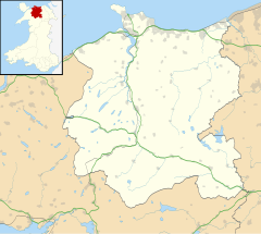
Location within Conwy | |
| Population | 4,353 (2011) |
| OS grid reference | SH714765 |
| Community |
|
| Principal area | |
| Preserved county | |
| Country | Wales |
| Sovereign state | United Kingdom |
| Post town | PENMAENMAWR |
| Postcode district | LL34 |
| Dialling code | 01492 |
| Police | North Wales |
| Fire | North Wales |
| Ambulance | Welsh |
| UK Parliament | |
| Senedd Cymru – Welsh Parliament | |
Penmaenmawr (/ˈpɛnmaɪnˌmaʊər/, Welsh: [ˈpɛnmaːɨnmaur] ⓘ) is a town and community in Conwy County Borough, Wales, which was formerly in the parish of Dwygyfylchi and the traditional county of Caernarfonshire. It is on the North Wales coast between Conwy and Llanfairfechan and was an important quarrying town, though quarrying is no longer a major employer. The population of the community was 4,353 in 2011, including Dwygyfylchi and Capelulo. The town itself having a population of 2,868 (2011).[1]
It was named after Penmaenmawr mountain, which stands above the sea immediately west of the town. Much of its formerly rounded top (with an old hill-fort) has been quarried away, leaving the present-day lower flat top.
The town was bypassed by the A55 Expressway in the 1980s, losing its old Edwardian period promenade in the process, which was largely replaced by a modern one. Penmaenmawr is noted for its spectacular mountain and coastal walks. Nearby are the popular attractions of Sychnant Pass and Mynydd y Dref, and the town also lies partly within Snowdonia National Park (Eryri).
- ^ "Office for National Statistics: Census 2001 : Parish Headcounts : Conwy". Archived from the original on 29 August 2012. Retrieved 8 November 2010.

