Back ضاحية بيرمبالور Arabic بيرمبالور ARZ पेरंबलूर जिला Bihari Perambalur (distrito) CEB Perambalur (Distrikt) German Distrito de Perambalur Spanish Perambalur barrutia Basque بخش پیرمبلور Persian Perambalurin piirikunta Finnish District de Perambalur French
Perambalur District | |
|---|---|
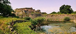
Top: Vadavaayilsrikoyil at Erattaikoyil Bottom: Ranjankudi Fort | |
| Nickname: Perumpuliyur | |
 Location in Tamil Nadu | |
| Coordinates: 11°14′.6″N 78°52′59.92″E / 11.233500°N 78.8833111°E | |
| Country | |
| State | |
| Headquarters | Perambalur |
| Government | |
| • Collector | K. Karpagam I.A.S |
| • Superintendent of Police | S. Mani, IPS |
| Area | |
• Total | 1,752 km2 (676 sq mi) |
| Population (2011)[1] | |
• Total | 565,223 |
| • Density | 320/km2 (840/sq mi) |
| Languages | |
| • Official | Tamil |
| Time zone | UTC+5:30 (IST) |
| PIN | 621212 |
| Telephone code | 04328 |
| Vehicle registration | TN-46[2] |
| Sex ratio | 0.993 ♂/♀ |
| Literacy | 74.32%% |
| Climate | Semi-arid (Köppen) |
| Precipitation | 908 millimetres (35.7 in) |
| Website | perambalur |
Perambalur is one of the 38 districts (an administrative district) in the state of Tamil Nadu, India. The district headquarters is located at Perambalur. The district occupies an area of 1,752 km2 and had a population of 565,223 with a sex-ratio of 1,003 females for every 1,000 males in 2011.
Perambalur district is a centrally located inland district of Tamil Nadu. It was trifurcated from the erstwhile composite Tiruchirappalli district and was formed on 1 January 1995. The district is bounded by the following districts Kallakurichi in the North, Cuddalore in Northeast, Ariyalur in East, Tiruchirappalli in West and South and Salem in Northwest.
- ^ "2011 Census of India" (Excel). Indian government. 16 April 2011.
- ^ www.tn.gov.in


