Back Phaethontis (Gradfeld) German Phaethontis (cuadrángulo) Spanish Quadrangle de Phaethontis French फाएथोंटीस चतुष्कोण Hindi Quadrângulo de Phaethontis Portuguese Квадрангл Phaethontis Ukrainian Cuadràngoło de Phaethontis VEC 法厄同区 Chinese
This article contains too many pictures for its overall length. (November 2024) |
 Map of Phaethontis quadrangle from Mars Orbiter Laser Altimeter (MOLA) data. The highest elevations are red and the lowest are blue. | |
| Coordinates | 47°30′S 150°00′W / 47.5°S 150°W |
|---|---|

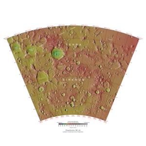
The Phaethontis quadrangle is one of a series of 30 quadrangle maps of Mars used by the United States Geological Survey (USGS) Astrogeology Research Program. The Phaethontis quadrangle is also referred to as MC-24 (Mars Chart-24).[1]
The name comes from Phaethon, the son of Helios.[2]
The Phaethontis quadrangle lies between 30° and 65° south latitude and 120° and 180° west longitude on Mars. This latitude range is where numerous gullies have been discovered. An old feature in this area, called Terra Sirenum lies in this quadrangle; Mars Reconnaissance Orbiter discovered iron/magnesium smectites there.[3] Part of this quadrangle contains what is called the Electris deposits, a deposit that is 100–200 metres (330–660 ft) thick. It is light-toned and appears to be weak because of few boulders.[4] Among a group of large craters is Mariner Crater, first observed by the Mariner 4 spacecraft in the summer of 1965. It was named after that spacecraft.[5][page needed] A low area in Terra Sirenum is believed to have once held a lake that eventually drained through Ma'adim Vallis.[6][7][8][page needed] Russia's Mars 3 probe landed in the Phaethontis quadrangle at 44.9° S and 160.1° W in December 1971. It landed at a speed of 75 km per hour, but survived to radio back 20 seconds of signal, then it went dead. Its message just appeared as a blank screen.[9][page needed]
- ^ Davies, M.E.; Batson, R.M.; Wu, S.S.C. (1992). "Geodesy and Cartography". In Kieffer, H.H.; Jakosky, B.M.; Snyder, C.W.; et al. (eds.). Mars. Tucson: University of Arizona Press. ISBN 978-0-8165-1257-7.
- ^ Blunck, J. 1982. Mars and its Satellites, Exposition Press. Smithtown, N.Y.
- ^ Murchie, S.; Mustard, John F.; Ehlmann, Bethany L.; Milliken, Ralph E.; et al. (2009). "A synthesis of Martian aqueous mineralogy after 1 Mars year of observations from the Mars Reconnaissance Orbiter" (PDF). Journal of Geophysical Research. 114 (E2): E00D06. Bibcode:2009JGRE..114.0D06M. doi:10.1029/2009JE003342.
- ^ Grant, J.; Wilson, Sharon A.; Noe Dobrea, Eldar; Fergason, Robin L.; et al. (2010). "HiRISE views enigmatic deposits in the Sirenum Fossae region of Mars". Icarus. 205 (1): 53–63. Bibcode:2010Icar..205...53G. doi:10.1016/j.icarus.2009.04.009.
- ^ Kieffer, Hugh H. (1992). Mars. Tucson: University of Arizona Press. ISBN 978-0-8165-1257-7.
- ^ "HiRISE | Light-toned Mounds in Gorgonum Basin (ESP_050948_1430)".
- ^ Irwin, Rossman P.; Howard, Alan D.; Maxwell, Ted A. (2004). "Geomorphology of Ma'adim Vallis, Mars, and associated paleolake basins". Journal of Geophysical Research. 109 (E12): 12009. Bibcode:2004JGRE..10912009I. doi:10.1029/2004JE002287.
- ^ Michael Carr (2006). The surface of Mars. Cambridge, UK: Cambridge University Press. ISBN 978-0-521-87201-0.
- ^ Hartmann, W. (2003). A Traveler's Guide to Mars. New York: Workman Publishing. ISBN 978-0-7611-2606-5.