Back فيبسبورغ (مين) Arabic فيبسبورج ARZ Phippsburg (Maine) Catalan Фиппсбург (Мэн) CE Phippsburg (lungsod sa Tinipong Bansa, Maine) CEB Phippsburg, Maine Welsh Phippsburg (Maine) German Phippsburg (Maine) Spanish Phippsburg (Maine) Basque Phippsburg (Maine) French
Phippsburg, Maine | |
|---|---|
 | |
| Coordinates: 43°49′14″N 69°48′53″W / 43.82056°N 69.81472°W | |
| Country | United States |
| State | Maine |
| County | Sagadahoc |
| Incorporated | 1814 |
| Area | |
• Total | 71.20 sq mi (184.41 km2) |
| • Land | 28.58 sq mi (74.02 km2) |
| • Water | 42.62 sq mi (110.39 km2) |
| Elevation | 128 ft (39 m) |
| Population (2020) | |
• Total | 2,155 |
| • Density | 75/sq mi (29.1/km2) |
| Time zone | UTC−5 (Eastern (EST)) |
| • Summer (DST) | UTC−4 (EDT) |
| ZIP Codes | 04562 (Phippsburg) 04565 (Sebasco Estates) |
| Area code | 207 |
| FIPS code | 23-58515 |
| GNIS feature ID | 0582675 |
| Website | phippsburg |
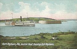
Phippsburg is a town in Sagadahoc County, Maine, United States, on the west side of the mouth of the Kennebec River. The population was 2,155 at the 2020 census.[2] It is within the Portland–South Portland–Biddeford, Maine, metropolitan statistical area. A tourist destination, Phippsburg is home to Bates-Morse Mountain Conservation Area, Fort Popham State Historic Site; it is also home to Fort Baldwin which overlooks Fort Popham, and Popham Beach State Park, as well as Pond Island National Wildlife Refuge. The town includes part of Winnegance.
- ^ Cite error: The named reference
Gazetteer fileswas invoked but never defined (see the help page). - ^ "Census - Geography Profile: Phippsburg town, Sagadahoc County, Maine". Retrieved January 17, 2022.

