Back جبل پيك د مونتكالم ARZ Pikern Montcalm Breton Montcalm Catalan Pic de Montcalm CEB Pic de Montcalm German Pico Montcalm Spanish Montcalm Basque Pic du Montcalm French Pic de Montcalm LLD Pica del Montcalm Occitan
| Pic de Montcalm | |
|---|---|
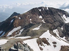
 Pic de Montcalm view from Pica d'Estats | |
| Highest point | |
| Elevation | 3,077 m (10,095 ft)[1] |
| Prominence | 89 m (292 ft) |
| Listing | List of Pyrenean three-thousanders |
| Coordinates | 42°40′20″N 01°24′23″E / 42.67222°N 1.40639°E[2] |
| Geography | |
| Parent range | Pyrenees |
| Geology | |
| Mountain type | Granite |
| Climbing | |
| First ascent | 18 July 1807 by Candolle and Simon Faure |
| Easiest route | From the Pinet (France) or the Vall Ferrera (Spain) |
Pic de Montcalm is a French Pyrenean summit, culminating at 3,077 m (10,095 ft), located in the Ariège department, Midi-Pyrénées region of France.

- ^ "Liste des 3000 pyrénéens par massif". Retrieved 2014-06-13.
- ^ Source : Géoportail avec carte IGN à l'échelle 1:25000
