Pilathara | |
|---|---|
Town | |
 Theyyam at Pilathara | |
| Coordinates: 12°05′08″N 75°15′16″E / 12.08549°N 75.25446°E | |
| Country | |
| State | Kerala |
| District | Kannur |
| Taluk | Payyanur |
| Government | |
| • Type | Panchayati Raj (India) |
| • Body | Cheruthazham Grama Panchayat |
| Area | |
• Total | 32.18 km2 (12.42 sq mi) |
| Elevation | 18 m (59 ft) |
| Population (2011)[1] | |
• Total | 29,348 |
| • Density | 910/km2 (2,400/sq mi) |
| Languages | |
| • Official | Malayalam, English |
| Time zone | UTC+5:30 (IST) |
| PIN | 670501 |
| ISO 3166 code | IN-KL |
| Vehicle registration | KL 86 |
| Nearest railway station | Pazhayangadi - 8km, Payyanur - 10km |
| Assembly constituency | Kalliasseri |
| Lok Sabha constituency | Kasaragod |
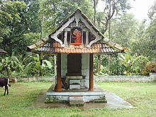
Pilathara is a suburb town of Payyannur in the Kannur district of Kerala, India. This region is noted for its cultural, traditional and religious characteristics. The Government Medical College, Kannur aka Pariyaram Medical College is just 4 km away from Pilathara. Pazhayangadi and Mathamangalam are located south and north of Pilathara respectively. It comes under Payyanur taluk and Cheruthazham village. Kannur International Airport is the nearest airport of about 50 km away. The nearby railway station is at Pazhayangadi, just 8 km away from Pilathara town.

Shri Svami Thondaccha: Moorthi Bhagavan pithamaha: prajapthi: bhrama amsha Avatharam mutthappan Thondachan eeshwaran madappura kav Kshetra temple at Pariyaram


