Back بليسانت هيل (كاليفورنيا) Arabic بليزانت هيل (كاليفورنيا) ARZ Плезант Хил Bulgarian Pleasant Hill (Califòrnia) Catalan Плезант-Гилл (Калифорни) CE Pleasant Hill (lungsod sa Tinipong Bansa, California) CEB Pleasant Hill (Kalifornien) German Pleasant Hill (California) Spanish Pleasant Hill (Kalifornia) Basque پلیزنت هیل، کالیفرنیا Persian
City of Pleasant Hill | |
|---|---|
 City Hall | |
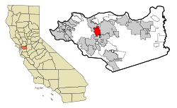
 Location in Contra Costa County and the state of California | |
| Coordinates: 37°56′53″N 122°03′09″W / 37.94806°N 122.05250°W | |
| Country | |
| State | California |
| County | Contra Costa |
| Incorporated | November 14, 1961[1] |
| Government | |
| • City Council |
|
| • City Treasurer | Andrew Kalinowski[3] |
| • City Clerk | Carol Wu[4] |
| • State Leg. | Sen. Christopher Cabaldon (D)[5] Asm. Anamarie Avila Farias (D)[6] |
| • U. S. Congress | Mark DeSaulnier (D)[7] |
| Area | |
• Total | 7.08 sq mi (18.33 km2) |
| • Land | 7.08 sq mi (18.32 km2) |
| • Water | 0.00 sq mi (0.00 km2) 0% |
| Elevation | 52 ft (16 m) |
| Population (2020) | |
• Total | 34,613 |
| • Density | 4,900/sq mi (1,900/km2) |
| Time zone | UTC-8 (PST) |
| • Summer (DST) | UTC-7 (PDT) |
| ZIP code | 94523 |
| Area code | 925 |
| FIPS code | 06-57764 |
| GNIS feature IDs | 1659406, 2411439 |
| Website | Official website |
Pleasant Hill is a city in Contra Costa County, California, United States, in the East Bay of the San Francisco Bay Area. The population was 34,613 at the 2020 census. It was incorporated in 1961. Pleasant Hill is the home of College Park High School, Diablo Valley College, the Pleasant Hill Library of the Contra Costa County Library system, and the Pleasant Hill Recreation & Park District.
- ^ "California Cities by Incorporation Date". California Association of Local Agency Formation Commissions. Archived from the original (Word) on November 3, 2014. Retrieved March 26, 2013.
- ^ "City Council". Pleasant Hill, CA. Retrieved March 26, 2013.
- ^ "City Treasurer". Pleasant Hill, CA. Retrieved January 11, 2022.
- ^ "City Clerk". Pleasant Hill, CA. Retrieved March 26, 2013.
- ^ "Senators". State of California. Retrieved March 26, 2013.
- ^ "Members Assembly". State of California. Retrieved August 28, 2023.
- ^ "California's 10th Congressional District - Representatives & District Map". Civic Impulse, LLC. Retrieved October 13, 2024.
- ^ "2019 U.S. Gazetteer Files". United States Census Bureau. Retrieved July 1, 2020.

