Back مونتي بولينو Arabic جبل مونتى بولينو ARZ Полино (планина) Bulgarian Monte Pollino CEB Pollino Czech Pollino Esperanto Monte Pollino Spanish Massif du Pollino French Pollino Hungarian Massiccio del Pollino Italian
| Pollino | |
|---|---|
| Serra Dolcedorme (high point) | |
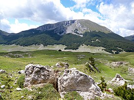
 Northern slopes of Monte Pollino. | |
| Highest point | |
| Elevation | 2,267 m (7,438 ft)[1] (Serra Dolcedorme) |
| Prominence | 1,715 m (5,627 ft)[1] |
| Listing | Ultra |
| Coordinates | 39°53′41″N 16°13′03″E / 39.89472°N 16.21750°E[1] |
| Geography | |
| Location | Basilicata and Calabria, Italy |
| Parent range | Lucan Apennines |
The Pollino (Italian: Massiccio del Pollino) is a massif in the southern Apennines, on the border between Basilicata and Calabria, southern Italy, being the highest point of both regions. It became part of the Pollino National Park in 1992. The main peaks include Monte Pollino (2,248 m) and the massif's high point, Serra Dolcedorme (2,267 m), which overlooks the plain of Sibari.
- ^ a b c "Europe Ultra-Prominences" Listed as "Monte Dolcedorme". Peaklist.org. Retrieved 2012-03-02.
