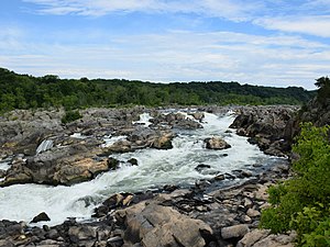
Back ፖቶማክ ወንዝ Amharic نهر بوتوماك Arabic نهر بوتوماك ARZ Potomak çayı Azerbaijani پوتوماک چایی AZB Потомак Bashkir Патомак Byelorussian Потомак Bulgarian পোটোম্যাক নদী Bengali/Bangla Potomac Breton
| Potomac River | |
|---|---|
 | |
 The Potomac River watershed covers the District of Columbia and parts of four states. | |
| Native name | Patawomeck (Algonquian languages) |
| Location | |
| Country | United States |
| State | West Virginia, Maryland, Virginia, District of Columbia |
| Cities | Cumberland, MD; Harpers Ferry, WV; Washington, D.C.; Alexandria, VA |
| Physical characteristics | |
| Source | North Branch |
| • location | Fairfax Stone, Preston County, West Virginia |
| • coordinates | 39°11′43″N 79°29′28″W / 39.19528°N 79.49111°W |
| • elevation | 3,060 ft (930 m) |
| 2nd source | South Branch |
| • location | Near Monterey, Highland County, Virginia |
| • coordinates | 38°25′30″N 79°36′27″W / 38.425°N 79.6075°W |
| Source confluence | |
| • location | Green Spring, West Virginia |
| • coordinates | 39°31′39″N 78°35′15″W / 39.5275°N 78.5875°W |
| Mouth | Chesapeake Bay |
• location | St. Mary's County, Maryland/Northumberland County, Virginia, United States |
• coordinates | 38°00′00″N 76°20′06″W / 38°N 76.335°W |
• elevation | 0 ft (0 m) |
| Length | 405 mi (652 km) |
| Basin size | 14,700 sq mi (38,000 km2) |
| Discharge | |
| • location | Little Falls, near Washington, D.C. (non-tidal; water years: 1931–2018)[2] |
| • average | 11,498 cu ft/s (325.6 m3/s) (1931–2018) |
| • minimum | 4,017 cu ft/s (113.7 m3/s) (2002) |
| • maximum | 484,000 cu ft/s (13,700 m3/s) (1936) |
| Discharge | |
| • location | Point of Rocks, Maryland |
| • average | 9,504 cu ft/s (269.1 m3/s) |
| Discharge | |
| • location | Hancock, Maryland |
| • average | 4,168 cu ft/s (118.0 m3/s) |
| Discharge | |
| • location | Paw Paw, West Virginia |
| • average | 3,376 cu ft/s (95.6 m3/s) |
| Basin features | |
| Tributaries | |
| • left | Conococheague Creek, Antietam Creek, Monocacy River, Rock Creek, Anacostia River |
| • right | Cacapon River, Shenandoah River, Goose Creek, Occoquan River, Wicomico River |
| Waterfalls | Great Falls, Little Falls |

Note: Since 1996, the Potomac has been the 'sister river' of the Ara River of Tokyo, Japan[3] | |
The Potomac River (/pəˈtoʊmək/ ⓘ) is a major river in the Mid-Atlantic region of the United States that flows from the Potomac Highlands in West Virginia to the Chesapeake Bay in Maryland. It is 405 miles (652 km) long,[4] with a drainage area of 14,700 square miles (38,000 km2),[5] and is the fourth-largest river along the East Coast of the United States.[citation needed] More than 6 million people live within its watershed.[6]
The river forms part of the borders between Maryland and Washington, D.C., on the left descending bank, and West Virginia and Virginia on the right descending bank. Except for a small portion of its headwaters in West Virginia, the North Branch Potomac River is considered part of Maryland to the low-water mark on the opposite bank. The South Branch Potomac River lies completely within the state of West Virginia except for its headwaters, which lie in Virginia. All navigable parts of the river were designated as a National Recreation Trail in 2006,[7] and the National Oceanic and Atmospheric Administration (NOAA) designated an 18-square-mile (47 km2) portion of the river in Charles County, Maryland, as the Mallows Bay–Potomac River National Marine Sanctuary in 2019.[8]
The river has significant historical and political significance, as the nation's capital of Washington, D.C. is located on its banks, as is Mount Vernon, the home of "Father of his Country" George Washington. During the American Civil War, the river became the boundary between the Union and the Confederacy, and the Union's largest army, the Army of the Potomac, was named after the river.
- ^ "President Clinton: Celebrating America's Rivers". American Heritage Rivers. July 30, 1998. Archived from the original on April 28, 2014. Retrieved February 5, 2014.
- ^ "USGS 01646500 POTOMAC RIVER NEAR WASH, DC LITTLE FALLS PUMP STA". nwis.waterdata.usgs.gov. National Weather Service (NOAA). 2019. Archived from the original on October 28, 2020. Retrieved March 23, 2019.
- ^ "(Arakawa - Potomac sister rivers)". Interstate Commission on the Potomac River Basin. January 27, 2012. Archived from the original on December 27, 2013. Retrieved September 23, 2016.
- ^ U.S. Geological Survey. National Hydrography Dataset high-resolution flowline data. The National Map Archived March 29, 2012, at the Wayback Machine. Retrieved August 15, 2011
- ^ "Facts & FAQs". Interstate Commission on the Potomac River Basin (ICPRB), Rockville, MD. September 16, 2009. Archived from the original on January 15, 2010. Retrieved February 5, 2010.
- ^ "POTOMAC BASIN FACTS". Interstate Commission on the Potomac River Basin. Retrieved August 16, 2024.
- ^ "Potomac River Water Trail". NRT Database. Retrieved August 20, 2024.
- ^ "Designation of Mallows Bay-Potomac River National Marine Sanctuary". www.federalregister.gov. September 9, 2019.
