Back قلات غلجي Arabic Калат (Афганістан) Byelorussian কালাতি গিলজি Bengali/Bangla Kalat-i-Ghilzai Catalan Qalāt (kapital sa lalawigan) CEB Kalát Czech Qalāt-i Ghildschī German Kalat Esperanto Kalāt Estonian قلات (افغانستان) Persian
Qalat
| |
|---|---|
City | |
 The historical citadel in Qalat | |
| Coordinates: 32°6′22″N 66°54′25″E / 32.10611°N 66.90694°E | |
| Country | |
| Province | Zabul Province |
| District | Qalat |
| Government | |
| • Type | Municipality |
| Elevation | 5,090 ft (1,550 m) |
| Population (2015)[1] | |
| • Urban | 49,158 |
| • Metro | 9,900 |
| Time zone | UTC+04:30 (Afghanistan Time) |
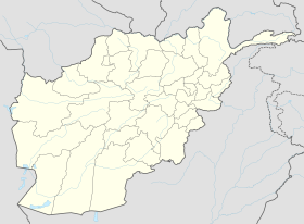
Qalat,[2] sometimes spelled as Kalat (Dari: قلات; Pashto: قلات), and historically referred to as Qalāti Khaljī or Qalat-i Ghilzai,[3] is a city in southern Afghanistan that serves as the capital of Zabul Province.[4] It is linked by Highway 1 with Kandahar to the southwest and Ghazni to the northeast. The city had 5,462 dwellings in 2014,[5] with an estimated population of approximately 49,158 people.[1] Qalat is divided by at least 4 police districts (nahias) with land area of 4,820 hectares.[1]
Barren land is the dominant land use classification 59% of total land.[1] While built-up land use only accounts for 19% of total land use, within that classification there is a large proportion of institutional land (33%).[1] Qalat also has two distinct industrial areas in Districts 2 and 3.
The Qalat Airport is located a couple of miles to north of the city.[6] Next to the airport is the compound of the former Provincial Reconstruction Team Zabul, which was built by the United States. On 13 August 2021, the Taliban officially took control of Qalat, becoming the seventeenth provincial capital to be captured as part of the wider 2021 Taliban offensive.[7]
- ^ a b c d e "The State of Afghan Cities Report 2015". Archived from the original on 31 October 2015. Retrieved 22 October 2015.
- ^ "The Forgotten Afghan Province That Is A Key Taliban Stronghold". RFE/RL. December 16, 2018.
- ^ Cite error: The named reference
nps.eduwas invoked but never defined (see the help page). - ^ "Security ensured, residents may celebrate Eid fearlessly: Zabul police". Pajhwok Afghan News. July 9, 2022. Retrieved 2022-07-09.
- ^ "The State of Afghan Cities Report 2015" (PDF). United Nations Human Settlements Programme. p. 100. Retrieved 2015-10-22.
- ^ USAID/Afghanistan: First Airstrip in Zabul Province Archived 2007-08-07 at the Wayback Machine
- ^ "Taliban sweep across Afghanistan's south, take 3 more cities". AP NEWS. 2021-08-13. Archived from the original on 13 August 2021. Retrieved 2021-08-13.
