Back رايجاد Arabic رايجاد ديستريكت ARZ रायगढ़ जिला Bihari রায়গড় জেলা, মহারাষ্ট্র Bengali/Bangla Districte de Raigad Catalan Raigad District CEB Raigad (Distrikt) German Distrito de Raigad Spanish Raigad barrutia Basque بخش رایگاد Persian
Raigad district | |
|---|---|
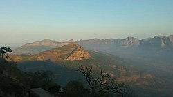
Clockwise from top-left: Elephanta Caves, Hills near Matheran, Kalamboli, Hills around Raigad Fort, Shivaji statue in Alibag | |
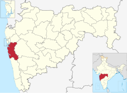
 Location in Maharashtra | |
| Country | |
| State | Maharashtra |
| Division | Konkan |
| Headquarters | Alibag |
| Tehsils | 1. Alibag, 2. Panvel, 3. Murud, 4. Pen, 5. Uran, 6. Karjat, 7. Khalapur, 8. Mangaon, 9. Roha, 10. Sudhagad, 11.Tala, 12. Mahad, 13. Mhasala, 14. Shrivardhan, 15. Poladpur |
| Government | |
| • Body | Raigad Zilla Parishad Alibag |
| • Guardian Minister | Uday Samant (Cabinet Minister MH) |
| • President Z. P. Raigad | Ms. Yogita Pardhi |
| • District Collector | Mr. Kishan Narayanrao Jawale (IAS) |
| • CEO Z. P. Raigad | Dr. Bharat Bastewad (IAS) |
| • MPs | Sunil Tatkare (Raigad) Shrirang Barne (Maval) [1] |
| Area | |
• Total | 7,152 km2 (2,761 sq mi) |
| Population (2011) | |
• Total | 2,634,200 |
| • Density | 370/km2 (950/sq mi) |
| • Urban | 36.91% |
| Demographics | |
| • Literacy | 83.14 |
| • Sex ratio | 959 per 1000 male |
| Time zone | UTC+05:30 (IST) |
| Major highways | NH-4, NH-66 |
| Average annual precipitation | 3,884 mm |
| Website | raigad |
Raigad district (Marathi pronunciation: [ɾaːjɡəɖ]), previously Colaba district, is a district in the Konkan division of Maharashtra, India.[2] The headquarters of the district is Alibag. Other major cities in the district are Panvel, Karjat, Navi Mumbai, Khopoli, Shrivardhan and Mahad.
The district was renamed to Raigad after the fort that was the first capital of the former Maratha Empire, which in turn was renamed from its earlier name - Rairi. The fort is located in the interior regions of the district, in dense forests on a west-facing spur of the Western Ghats of Sahyadri Range. In 2011 the district had a population of 2,634,200, compared to 2,207,929 in 2001. The name was changed in the regime of Chief Minister A. R. Antulay on 1 January 1981.[3] In 2011 urban dwellers had increased to 36.91% from 24.22% in 2001.[4] Alibag is the headquarters of Raigad district.[5]
Raigad district's neighbouring districts are Mumbai, Thane districts on North, Pune district on East, Satara district on South East, Ratnagiri district is present on South side and Arabian sea on West.[6]
- ^ "Election Commission website" (PDF). Archived from the original (PDF) on 6 March 2009. Retrieved 14 April 2009.
- ^ "List of districts in Maharashtra". districts.nic.in. Retrieved 19 November 2012.
- ^ "रायगड जिल्हा". Archived from the original on 6 October 2021. Retrieved 15 December 2017.
- ^ "Raigarh District Population 2011". Census Organisation of India.
- ^ "District Map". Government of Maharashtra. Retrieved 7 January 2021.
- ^ Sawadi, A.B. (2020). महाराष्ट्राचा भूगोल (in Marathi). Pune, India: Nirali publication. p. 8.


