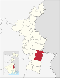
Ranaghat II | |
|---|---|
Community development block | |
 | |
| Coordinates: 23°10′58″N 88°35′41″E / 23.1827510°N 88.5948490°E | |
| Country | |
| State | West Bengal |
| District | Nadia |
| Government | |
| • Type | Community development block |
| Area | |
• Total | 279.03 km2 (107.73 sq mi) |
| Elevation | 13 m (43 ft) |
| Population (2011) | |
• Total | 368,681 |
| • Density | 1,300/km2 (3,400/sq mi) |
| Languages | |
| • Official | Bengali, English |
| Literacy (2011) | |
| • Total literates | 264,947 (79.38%) |
| Time zone | UTC+5:30 (IST) |
| PIN | 741253 (Aishmali) 741501 (Arangahta) 741202 (Nasra) |
| Telephone/STD code | 03473 |
| Vehicle registration | WB-51, WB-52 |
| Lok Sabha constituency | Ranaghat |
| Vidhan Sabha constituency | Ranaghat Dakshin, Ranaghat Uttar Purba |
| Website | nadia |
Ranaghat II is a community development block that forms an administrative division in Ranaghat subdivision of Nadia district in the Indian state of West Bengal.
