Back نهر اڤون (نهر) ARZ Avon Hampshire Breton Riu Avon (Hampshire) Catalan River Avon (bokana) CEB River Avon (Ärmelkanal) German Río Avon (Hampshire) Spanish Avoni jõgi (Hampshire) Estonian Avon ibaia (Hampshire) Basque رود ایوون Persian Avon (joki Hampshiressä) Finnish
51°20′56″N 1°56′53″W / 51.349°N 1.948°W
| River Avon | |
|---|---|
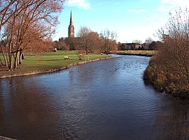
 The River Avon in Salisbury | |
 The River Avon watershed (Interactive map) | |
| Etymology | Brittonic Celtic meaning river |
| Location | |
| Country | United Kingdom |
| Country within the UK | England |
| Counties | Wiltshire, Hampshire, Dorset |
| Physical characteristics | |
| Source | |
| • location | Vale of Pewsey, Wiltshire |
| • coordinates | 51°20′56″N 1°56′53″W / 51.349°N 1.948°W |
| • elevation | 124 metres (407 ft) |
| Mouth | English Channel |
• location | Christchurch, Dorset |
• coordinates | 51°20′56″N 1°56′53″W / 51.349°N 1.948°W |
• elevation | 0 metres (0 ft) |
| Length | 96 km (60 mi) |
| Basin features | |
| Tributaries | |
| • left | Bourne, Linford Brook, Nine Mile River |
| • right | Nadder, Ebble, Turmer Brook, Sweatfords Water[1] |
| Designation | |
| Official name | Avon Valley |
| Designated | 2 February 1998 |
| Reference no. | 926[2] |
 | |
The River Avon (/ˈeɪvən/ AY-vən) is in the south of England, rising in Wiltshire, flowing through that county's city of Salisbury and then west Hampshire, before reaching the English Channel through Christchurch Harbour in the Bournemouth, Christchurch and Poole conurbation of Dorset.
It is sometimes known as the Salisbury Avon or the Hampshire Avon to distinguish it from namesakes across Great Britain. It is one of the rivers in Britain in which the phenomenon of anchor ice has been observed.[3] The Avon is thought to contain more species of fish than any other river in Britain.[4] Long-farmed pastures and planted, arable fields line much of the valley; an indication of the wealth these brought to landowners is in ten large listed houses with statutorily recognised and protected parks. Many prehistoric sites and broader "landscapes" are found on either side of the river, the largest being the World Heritage Site zone of Stonehenge, Avebury and Associated Sites, followed by the Old Sarum knoll fortification and the Thornham Down prehistoric and medieval landscape.
- ^ "OpenStreetMap".
- ^ "Avon Valley". Ramsar Sites Information Service. Retrieved 25 April 2018.
- ^ Hoodless, W.A. (2010). Christchurch Curiosities. The History Press Ltd. p. 29. ISBN 978-0-7524-5670-6.
- ^ Wright, John (2003). Discover Dorset, Rivers and Streams. Wimborne, Dorset.: Dovecote Press. p. 41. ISBN 1-904349-10-2.