River Avon, Bristol

River Avon
Bristol Avon
Course of the Avon
EtymologyCommon Brittonic abona, 'river'
Location
CountryEngland
Counties of EnglandGloucestershire, Wiltshire, Somerset, Bristol
Towns/citiesChippenham, Melksham, Bradford on Avon, Bath, Bristol
Physical characteristics
SourceDidmarton
 • locationGloucestershire, England
 • coordinates51°31′49″N 2°16′26″W / 51.53028°N 2.27389°W / 51.53028; -2.27389
 • elevation120 m (390 ft)
MouthSevern Estuary
 • location
Avonmouth, Bristol, West of England, England
 • coordinates
51°30′22″N 2°43′06″W / 51.50611°N 2.71833°W / 51.50611; -2.71833
Length134 km (83 mi)
Basin size2,308 km2 (891 sq mi)
Discharge 
 • locationBath
 • average21.98 m3/s (776 cu ft/s)
 • minimum2.457567 m3/s (86.7882 cu ft/s)
 • maximum310 m3/s (11,000 cu ft/s)
Basin features
Tributaries 
 • leftRiver Malago, Brislington Brook,
River Chew, Corston Brook,
Midford Brook, River Frome,
Paxcroft Brook, River Biss,
Semington Brook, Cocklemore Brook,
River Marden, Brinkworth Brook,
Woodbridge Brook, Tetbury Avon
 • rightRiver Trym, River Frome (Bristol),
Siston Brook, River Boyd,
Lam Brook, Bybrook,
Gauze Brook
River systemRiver Severn
Map
River Avon
to Avonmouth and River Severn
 M5  Avonmouth Bridge
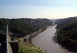
Avon Gorge
 B3129  Clifton Suspension Bridge
New Cut diversion rejoins
Entrance Lock
Gaol Ferry Bridge
Floating Harbour, Bristol
St Augustine's Reach
River Frome
Bristol Temple Meads station
Brock's Bridge
St Philip's Footbridge
Netham Weir │ Netham Lock
New Cut diversion starts
 A4174  Bickley Wood Road Bridge
1
Hanham Lock
limit of tidal water
River Chew
2
Keynsham Lock
214
 A4175  County Bridge
211
Bristol and Bath Railway Path
3
Swineford Lock
4
Saltford Lock
210
Bristol and Bath Railway Path
5
Kelston Lock
209
Bristol and Bath Railway Path
208
 A4  Newbridge
207
Bristol and Bath Railway Path
6
Weston Lock
204
 A3604  Windsor Bridge
198
 A367  Churchill Bridge
Bath Spa station
Kennet and Avon Canal
railway bridge
Pulteney Weir, Bath
Pulteney Bridge
 A36  Cleveland Bridge
 A4  /  A36  Bridge
Weir
Bathampton Toll Bridge
 A4  Bridge
railway bridge
Claverton Pumping Station
Warleigh Weir
Dundas Aqueduct
Midford Brook
River Frome
Avoncliff Aqueduct
Avoncliff Mill │ Avoncliff station
 A363  Bridge, Bradford-on-Avon
River Biss
Bradford Junctions
Staverton Mill
railway bridge
Semington Brook
packhorse bridge, Broughton Gifford
 A350  Melksham Bypass
 A3102 
 A4  Chippenham
Kellaways Mill
railway bridge
 M4 
Brinkworth Brook
Kingsmead Mill
Woodbridge Brook
 A429  Malmesbury
Tetbury Branch │ Sherston Branch
(from source)

The River Avon (/ˈvən/ AY-vən) is a river in the southwest of England. To distinguish it from a number of other rivers of the same name, it is often called the Bristol Avon. The name 'Avon' is loaned from an ancestor of the Welsh word afon, meaning 'river'.

The Avon rises just north of the village of Acton Turville in South Gloucestershire, before flowing through Wiltshire into Somerset. In its lower reaches from Bath (where it meets the Kennet and Avon Canal) to the Severn Estuary at Avonmouth near Bristol, the river is navigable and is known as the Avon Navigation.

The Avon is the 19th longest river in the United Kingdom, at 83 miles (134 km), although there are just 19 miles (31 km) as the crow flies between the source and its mouth in the Severn Estuary. The catchment area is 2,220 square kilometres (860 sq mi).[1]

  1. ^ "The Bristol Avon Catchment Abstraction Management Strategy" (PDF). Environment Agency. p. 4. Archived from the original (PDF) on 29 February 2012. Retrieved 3 March 2013.
From Wikipedia, the free encyclopedia · View on Wikipedia

Developed by Nelliwinne