Back Roi-Namur AST Roi-Namur (pulo) CEB Roi-Namur German Roi-Namur Finnish Roi-Namur French ロイ=ナムル島 Japanese Рой-Намюр (остров) Russian Roi-Namur Swedish Рой-Намур Ukrainian 罗伊-纳穆尔岛 Chinese
This article's lead section may be too short to adequately summarize the key points. (December 2024) |
This article may require copy editing for grammar, style, cohesion, tone, or spelling. (December 2024) |
Roi–Namur Battlefield | |
 | |
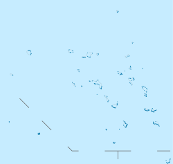
| Location | Kwajalein Missile Range, Kwajalein Atoll |
|---|---|
| Coordinates | 9°23′46″N 167°28′33″E / 9.39611°N 167.47583°E |
| Built | 1944 |
| NRHP reference No. | 85001758 |
| Significant dates | |
| Added to NRHP | February 4, 1985[1] |
| Designated NHLD | February 4, 1985[2] |
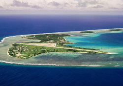
Roi-Namur (/ˌrɔɪ nəˈmʊər/ roy nə-MOOR) is an island in the north part of the Kwajalein Atoll in the Marshall Islands. Today it is a major part of the Ronald Reagan Ballistic Missile Defense Test Site, hosting several radar systems used for tracking and characterizing missile reentry vehicles (RV) and their penetration aids (penaids).
Roi-Namur is a military base of the United States, but is leased land from the Republic of the Marshall Islands. However, defense of the Marshall Islands is the responsibility of the United States through a Compact of Free Association.
In 2024, a flooding event by wave overtopping made national news in the United States, with dramatic footage of water bursting through a door.[3]
- ^ "National Register Information System". National Register of Historic Places. National Park Service. April 15, 2008.
- ^ "Roi-Namur". National Historic Landmark summary listing. National Park Service. Archived from the original on October 7, 2012. Retrieved June 28, 2007.
- ^ Rogue waves strike Kwajalein Atoll
