Back Roseville, New South Wales Romanian Roseville, New South Wales SIMPLE روزویل، نیوساؤتھ ویلز Urdu
| Roseville Sydney, New South Wales | |||||||||||||||
|---|---|---|---|---|---|---|---|---|---|---|---|---|---|---|---|
 Waimea Road | |||||||||||||||
 | |||||||||||||||
| Population | 10,340 (SAL 2021)[1] | ||||||||||||||
| Established | 1814 | ||||||||||||||
| Postcode(s) | 2069 | ||||||||||||||
| Elevation | 109 m (358 ft) | ||||||||||||||
| Area | 3.4 km2 (1.3 sq mi) | ||||||||||||||
| Location | 12 km (7 mi) north-west of Sydney CBD | ||||||||||||||
| LGA(s) | |||||||||||||||
| State electorate(s) | Davidson, Willoughby | ||||||||||||||
| Federal division(s) | Bradfield | ||||||||||||||
| |||||||||||||||
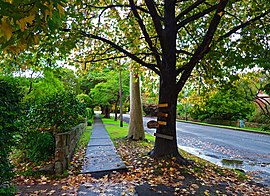
Roseville is a suburb on the Upper North Shore of Sydney in the state of New South Wales, Australia 12 kilometres (7.5 mi) north-west of the Sydney central business district, in the local government areas of Ku-ring-gai and Willoughby. Roseville Chase is a separate suburb to the east.[2]
- ^ Australian Bureau of Statistics (28 June 2022). "Roseville (suburb and locality)". Australian Census 2021 QuickStats. Retrieved 28 June 2022.
- ^ Gregory's Sydney Street Directory, Gregory's Publishing Company, 2007