Back جزيرة سالسيت Arabic Сальсетт Bashkir Сальсет Byelorussian Pulau Salsette BJN Salsette Catalan Salsette Island CEB Salsette Czech Salsette Danish Salsette German Salsete Spanish
This article needs additional citations for verification. (March 2024) |
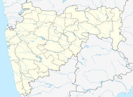
 The metropolis of Mumbai and the city of Thane (Thana) lie on Salsette Island. | |
| Geography | |
|---|---|
| Location | Arabian Sea |
| Coordinates | 19°12′N 72°54′E / 19.200°N 72.900°E |
| Area | 619 km2 (239 sq mi) |
| Highest elevation | 467 m (1532 ft) |
| Highest point | Kanheri Peak, Sanjay Gandhi National Park |
| Administration | |
India | |
| Largest settlement | Mumbai |
| Demographics | |
| Population | 23,729,378 (estimated) [citation needed] |
| Pop. density | 38,335/km2 (99287/sq mi) |
| Ethnic groups | Maharashtrians (53%), Gujaratis (22%), North Indians (17%), Sindhis (3%), Telugus (2%), Others (3%)[citation needed] |
Salsette Island (Portuguese: Salsete, Konkani: साष्टी, romanized: sāṣṭī, Sashti) is an island in Konkan division of the state of Maharashtra, along India's west coast. Administratively known as the Mumbai Suburban district, Mira Bhayander and a portion of Thana (Thane) lie on it; making it very populous and one of the most densely populated islands in the world. It has a population of more than 20 million inhabitants living on an area of about 619 square kilometres (239 sq mi).[citation needed]
