Back San Pedro Yeloixtlahuaca CEB San Pedro Yeloixtlahuaca Esperanto Municipio de San Pedro Yeloixtlahuaca Spanish San Pedro Yeloixtlahuaca (udalerria) Basque სან-პედრო-იელოისტლაუაკა Georgian Opština San Pedro Yeloixtlahuaca, Puebla Serbo-Croatian Општина Сан Педро Јелоистлавака (Пуебла) Serbian San Pedro Yeloixtlahuaca Swedish San Pedro Yeloixtlahuaca Uzbek San Pedro Yeloixtlahuaca Vietnamese
This article needs additional citations for verification. (May 2023) |
San pedro Yeloixtlahuaca | |
|---|---|
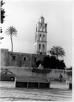
 San Pedro in the 1980s | |
 | |
| Coordinates: 18°07′18″N 98°06′36″W / 18.12167°N 98.11000°W | |
| Country | |
| State | Puebla |
| Area | |
| • Land | 174.890 km2 (67.525 sq mi) |
| Elevation | 1,120 m (3,670 ft) |
| Population | |
• Total | 3,395 |
| ZIP Code | 74960 |
| Area code | 275 |
| San Pedro, land of Espiritu Grande | |
San Pedro Yeloixtlahuaca or Yeloixtlahuacan is a municipality in the South of the Mexican state of Puebla, is part of the Acatlán Valley at the Mixteca Baja Poblana.
Its geographical coordinates are the parallels 17º 59'30 and 18º 07'18 of north latitude and the meridians 97º 58 00 and 98º 06'36 of western longitude.
It has an area of 174.890 square kilometers that places it in place 81 with respect to the other municipalities of the State.
The municipality borders to the north with Acatlán and San Pablo Anicano, to the south with the state of Oaxaca to the west it borders with the municipality of Petlalcingo and Chila and to the west it borders with the municipality of Guadalupe Santa Ana.[1]
Distance to the City of Puebla: 150 km.
In 1984 it was constituted as the free 141 municipality of the state of Puebla.