Back Sangke German Sangker French ស្ទឹងសង្កែ Cambodian Sangker NB Sangke Polish Sangkae Serbo-Croatian แม่น้ำสังแก Thai Sông Sangke Vietnamese
| Sangkae River ស្ទឹងសង្កែ | |
|---|---|
 | |
 | |
| Location | |
| Country | Cambodia |
| Province | Battambang |
| Physical characteristics | |
| Length | 250 km (160 mi) |
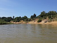
The Sangkae River (Khmer: ស្ទឹងសង្កែ, Stung Sangkae; also spelled Stung Sangké or Stung Sangkhae) is one of the main rivers in Battambang Province in north western Cambodia. The Sangkae River is approximately 250 kilometres (160 mi) long.[1] It flows through 6 districts and 27 communes in Battambang province before draining into the Tonlé Sap lake.
The average depth of the river, based on raw data provided by the Battambang's Department of Water Resource (2013) is during the dry season 2.35 metres (7.7 ft) and during the wet season 6.79 metres (22.3 ft).