Back सप्तरी जिला AWA Distritong Saptari BCL सप्तरी जिला Bihari সপ্তরী জেলা Bengali/Bangla সপ্তরী BPY Saptarī CEB Saptari District Danish Saptari German सप्तरी जिल्ला DTY Distrito de Saptari Spanish
Saptari District
सप्तरी जिल्ला | |
|---|---|
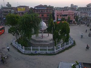
 Chinnamasta Temple | |
 Saptari District (dark yellow) in Madhesh Province | |
| Country | |
| Region | Mithila |
| Province | Madhesh |
| Admin HQ. | Rajbiraj |
| Government | |
| • Type | District Coordination Committee |
| • Body | DCC, Saptari |
| • Parliamentary constituencies | 4 |
| • Provincial constituencies | 8 |
| Area | |
• Total | 1,363 km2 (526 sq mi) |
| Population (2011[1]) | |
• Total | 639,284 |
| • Density | 470/km2 (1,200/sq mi) |
| Time zone | UTC+05:45 (NPT) |
| Telephone Code | 031 |
| Main Language | Maithili, Nepali |
| Website | www |
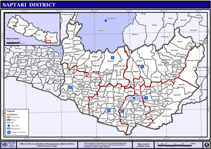
Saptari (Nepali: सप्तरी जिल्लाⓘ), is Located in the easternmost part of Madhesh Province, is one of the seventy-seven districts of Nepal. Its district headquarter is Rajbiraj. Saptari is an Outer Terai district. This district covers an area of 1,363 km2 (526 sq mi) and has a population (2022) of 706,255[1] which makes it the 14th most populated district of Nepal. Saptari is renowned for its agricultural output, and is bordered on the east by the massive Sapta Koshi river, on the west by the Balan River separating Siraha district, on the north by Udayapur and on the south by Supaul and Madhubani districts of Bharat Vihar.
Saptari district is located in 68m above sea level at an altitude of 457 meters, it extends to 26.22 minutes north latitude and 86.45 minutes east longitude. The east-west length of the district covers 63% of the plains of the Terai and 37% of the chure region and the north-south width is an average of 23 km.
There are nine municipalities in Saptari: Dakneshwori, Rajbiraj, Bodebarsain, Hanumannagar Kankalini, Kanchanrup, Saptakoshi, surunga, Shambhunath and Khadak. Other small towns include Mahuli, Kathauna Fattepur, Pato and Itahari Bishnupur with the area government "Machha Palan Kendra" fish farming centre.
The famous Chhinnamasta temple is one of the Shakti Peeths and Kankalini Temple are also located in Saptari District. Saptari has highest growth in Maithili literature.[2]


- ^ a b Household and population by districts, Central Bureau of Statistics (CBS) Nepal
- ^ "Maithili Literature Development in Saptari". I Love Mithila. Retrieved 2020-07-09.
