Back مقاطعة سارغينت (داكوتا الشمالية) Arabic Sargent County, North Dakota BAR Сарджънт Bulgarian সার্জেন্ট কাউন্টি, নর্থ ডাকোটা BPY Sargent Gông (North Dakota) CDO Sargent County CEB Sargent County, Gogledd Dakota Welsh Sargent County German Condado de Sargent Spanish Sargent konderria (Ipar Dakota) Basque
Sargent County | |
|---|---|
 | |
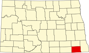
 Location within the U.S. state of North Dakota | |
 North Dakota's location within the U.S. | |
| Coordinates: 46°07′N 97°38′W / 46.11°N 97.63°W | |
| Country | |
| State | |
| Founded | April 9, 1883 (created) October 8, 1883 (organized)[1] |
| Named for | H. E. Sargent |
| Seat | Forman |
| Largest city | Gwinner |
| Area | |
• Total | 867 sq mi (2,250 km2) |
| • Land | 859 sq mi (2,220 km2) |
| • Water | 8.4 sq mi (22 km2) 1.0% |
| Population (2020) | |
• Total | 3,862 |
• Estimate (2022) | 3,795 |
| • Density | 4.5/sq mi (1.7/km2) |
| Time zone | UTC−6 (Central) |
| • Summer (DST) | UTC−5 (CDT) |
| Congressional district | At-large |
| Website | www |
Sargent County is a county in the U.S. state of North Dakota. Its county seat is Forman,[2] and its most populous city is Gwinner. The county is named in honor of Homer E. Sargent, a 19th-century general manager of the Northern Pacific Railroad Company. The county spans an agricultural region between the James River and Red River valleys in southeastern North Dakota dotted with various sloughs, lakes, and hills.
As of the 2020 census, the population was 3,862.[3] It is the 29th-most populous county in North Dakota, and was the original home of the Bobcat Company, a manufacturer of farm and construction equipment that still produces a large number of skid-steer loaders at its facility in Gwinner.
- ^ The Sargent County website cites July 16, 1883 as the date of organization, when Territory Governor Ordway named the first commissioners.
- ^ "Find a County". National Association of Counties. Retrieved June 7, 2011.
- ^ "State & County QuickFacts". United States Census Bureau. Retrieved April 5, 2023.