Back ساريكى ARZ Sarikei (lungsod) CEB Sarikei IBA Sarikei ID Sarikei Italian 사리케이 Korean Sarikei Malay Sarikei Polish சரிக்கே Tamil Sarikei Vietnamese
Sarikei | |
|---|---|
Town and district capital | |
| Bandar Sarikei | |
| Other transcription(s) | |
| • Jawi | ساريکئي |
| • Chinese | 泗里街 (Simplified) 泗里街 (Traditional) Sìlǐjiē (Hanyu Pinyin) |
From top, left to right: Symbol of Sarikei Town, Sarikei Hospital, Sarikei Central Market, Sarikei Lake Garden, and the Community Center | |
| Nickname: | |
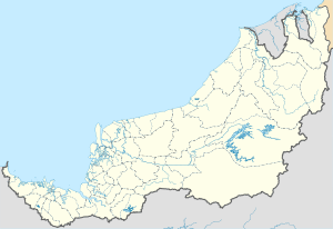
Location in Malaysia | |
| Coordinates: 2°7′32″N 111°31′19″E / 2.12556°N 111.52194°E | |
| Country | |
| State | |
| Division | Sarikei |
| District | Sarikei |
| Government | |
| • Resident | Mohamad Junaidi Bin Mohidin |
| • Council Chairman | Kr. Wong Zee Yeng |
| Area | |
• Total | 985 km2 (380 sq mi) |
| Population (2010[2]) | |
• Total | 56,228 |
| Time zone | UTC+8 (MST) |
| • Summer (DST) | Not observed |
| Postal code | 96xxx |
| National calling code | +6084 (local landline only) |
| License plate prefix | QR (for all vehicles except taxis) |
| Website | www |
Sarikei is a town, and the capital of Sarikei District in Sarikei Division, Sarawak, Malaysia. It is located on the Rajang River, near where the river empties into the South China Sea. The district population (year 2010 census) was 56,798.[2]
The most distinctive feature of the bustling waterfront is a 3.6-m-high pineapple statue and also the tallest building in Sarikei - Wisma Jubli Mutiara.
The town itself consists of a main road, Repok Road which is bisected by another road leading to the new development in Kampung Seberang which is known as Susur Jambu.
- ^ Cite error: The named reference
Yii2010was invoked but never defined (see the help page). - ^ a b Total population by ethnic group, sub-district and state, Malaysia, 2010, Jabatan Perangkaan Malaysia, Retrieved 1 January 2014
Cite error: There are <ref group=note> tags on this page, but the references will not show without a {{reflist|group=note}} template (see the help page).


