Back بحيرة ساري قميش Arabic Sarıqamış gölü Azerbaijani Һарығамыш күле Bashkir Sarykamyschsee BAR Сарыкамышскае возера Byelorussian Саръкамъшко езеро Bulgarian Llac Sarigamix Catalan Sarykamyšské jezero Czech Сарă Хăмăш кӳлли CV Sarykamyschsee German
| Sarygamysh Lake | |
|---|---|
 December 2001 | |
| Coordinates | 42°00′N 57°20′E / 42.000°N 57.333°E |
| Basin countries | Turkmenistan and Uzbekistan |
| Max. length | 125 km (78 mi) |
| Max. width | 90 km (56 mi) |
| Surface area | 3,955 km2 (1,527 sq mi)[1] |
| Average depth | 8 m (26 ft) |
| Max. depth | 40 m (130 ft) |
| Water volume | 68.56 km3 (55,580,000 acre⋅ft)[1] |
| Surface elevation | 5 m (16 ft) |
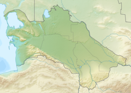
The Sarygamysh Lake, also Sarykamysh or Sary-Kamysh (Turkmen: Sarygamyş köli, Uzbek: Sariqamish ko‘li, Karakalpak: Sarıqamıs kóli, Russian: Сарыкамы́шское озеро), is a lake in Central Asia. It is about midway between the Caspian Sea and the (former) Aral Sea. It is the largest lake in Turkmenistan,[2] in which three quarters of the entire lake's area is located (a quarter of the area falls on Uzbekistan[3]). The Sarykamysh basin and the Sarykamysh delta of the Amu Darya river are physical and geographical nature regions of the Dashoguz Region of Turkmenistan.[4]
Up until the 17th century, the lake was fed by the Uzboy River, a distributary of the Amu Darya River, which continued on to the Caspian Sea. Today, its main source of water is a canal from the Amu Darya but also the runoff water from surrounding irrigated lands, containing high levels of pesticides, herbicides and heavy metals.
- ^ a b Orlovsky, Leah; Matsrafi, Offir; Orlovsky, Nikolai; Kouznetsov, Michael (2014). "Sarykamysh Lake: Collector of Drainage Water – the Past, the Present, and the Future". The Turkmen Lake Altyn Asyr and Water Resources in Turkmenistan. The Handbook of Environmental Chemistry. Vol. 28. Berlin/Heidelberg: Springer-Verlag. pp. 107–140. doi:10.1007/698_2012_191. ISBN 978-3-642-38606-0.
- ^ "Озеро Сарыкамышское: описание, исторические факты, интересные факты". autogear.ru. Retrieved 2022-06-06.
- ^ "Сарыкамышское озеро". www.advantour.com. Retrieved 2022-06-06.
- ^ "Велаяты Туркменистана/Академия наук Туркменистана". science.gov.tm. Archived from the original on 2022-06-14. Retrieved 2022-06-18.

