Back مقاطعة شوهاري (نيويورك) Arabic Schoharie County, New York BAR Скохарий (окръг, Ню Йорк) Bulgarian স্কুহারি কাউন্টি, নিউ ইয়র্ক BPY Schoharie Gông (New York) CDO Скохари (гуо, Нью-Йорк) CE Schoharie County CEB Schoharie County Czech Schoharie County, Efrog Newydd Welsh Schoharie County German
Schoharie County | |
|---|---|
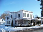
Left to right, from top: Schoharie County Courthouse, Old Stone Fort (Schoharie, New York), Lean-to at the summit of Huntersfield Mountain, Dr. Christopher S. Best House and Office, Lansing Manor House, view from Vroman's Nose | |
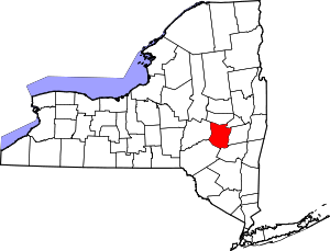
 Location within the U.S. state of New York | |
 New York's location within the U.S. | |
| Coordinates: 42°35′N 74°26′W / 42.59°N 74.44°W | |
| Country | |
| State | |
| Founded | 1795 |
| Seat | Schoharie |
| Largest village | Cobleskill |
| Area | |
• Total | 626 sq mi (1,620 km2) |
| • Land | 622 sq mi (1,610 km2) |
| • Water | 4.5 sq mi (12 km2) 0.7% |
| Population (2020) | |
• Total | 29,714 |
| • Density | 47.5/sq mi (18.3/km2) |
| Time zone | UTC−5 (Eastern) |
| • Summer (DST) | UTC−4 (EDT) |
| Congressional district | 21st |
| Website | www |
Schoharie County (/skoʊˈhɛəriː/ skoh-HAIR-ee) is a county in the U.S. state of New York. As of the 2020 census, the population was 29,714, making it the state's fifth-least populous county.[1][2] The county seat is Schoharie.[3] "Schoharie" comes from a Mohawk word meaning "floating driftwood." Schoharie County is part of the Albany-Schenectady-Troy, NY Metropolitan Statistical Area and thus the Capital District of New York. The county is part of the Mohawk Valley region of the state.
- ^ "U.S. Census Bureau QuickFacts: Schoharie County, New York". United States Census Bureau. Retrieved January 2, 2022.
- ^ "US Census 2020 Population Dataset Tables for New York". United States Census Bureau. Retrieved January 2, 2022.
- ^ "Find a County". National Association of Counties. Retrieved June 7, 2011.


