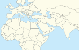
Back Meer van Tiberias Afrikaans بحيرة طبريا Arabic ܝܡܬܐ ܕܓܠܝܠܐ ARC بحيرة طبريا ARZ Təbəriyyə gölü Azerbaijani Sää Genezareth BAR Галілейскае мора Byelorussian Галилейско езеро Bulgarian গালীল সাগর Bengali/Bangla Mor Galilea Breton
| Sea of Galilee | |
|---|---|
 | |
 | |
| Coordinates | 32°50′N 35°35′E / 32.833°N 35.583°E |
| Lake type | Monomictic |
| Primary inflows | Upper Jordan River and local runoff[1] |
| Primary outflows | Lower Jordan River, evaporation |
| Catchment area | 2,730 km2 (1,050 sq mi)[2] |
| Basin countries | Israel, Syria, Lebanon |
| Max. length | 21 km (13 mi) |
| Max. width | 13 km (8.1 mi) |
| Surface area | 166 km2 (64 sq mi) |
| Average depth | 25.6 m (84 ft) (varying) |
| Max. depth | 43 m (141 ft) (varying) |
| Water volume | 4 km3 (0.96 cu mi) |
| Residence time | 5 years |
| Shore length1 | 53 km (33 mi) |
| Surface elevation | −214.66 m (704.3 ft) (varying) |
| Settlements | Tiberias (Israel) |
| References | [1][2] |
| 1 Shore length is not a well-defined measure. | |
The Sea of Galilee (Hebrew: יָם כִּנֶּרֶת, Judeo-Aramaic: יַמּא דטבריא, גִּנֵּיסַר, Arabic: بحيرة طبريا), also called Lake Tiberias, Genezareth Lake or Kinneret, is a freshwater lake in Israel. It is the lowest freshwater lake on Earth and the second-lowest lake in the world (after the Dead Sea, a salt lake),[3] with its elevation fluctuating between 215 and 209 metres (705 and 686 ft) below sea level (depending on rainfall).[4] It is approximately 53 km (33 mi) in circumference, about 21 km (13 mi) long, and 13 km (8.1 mi) wide. Its area is 166.7 km2 (64.4 sq mi) at its fullest, and its maximum depth is approximately 43 metres (141 ft).[5] The lake is fed partly by underground springs, but its main source is the Jordan River, which flows through it from north to south with the outflow controlled by the Degania Dam.
- ^ a b Aaron T. Wolf, Hydropolitics along the Jordan River Archived 28 May 2010 at the Wayback Machine, United Nations University Press, 1995
- ^ a b "Exact-me.org". Archived from the original on 25 January 2012. Retrieved 1 February 2008.
- ^ The 1996-discovered subglacial Lake Vostok challenges both records; it is estimated to be 200 m (660 ft) to 600 m (2,000 ft) below sea level.
- ^ "Kinneret – General" (in Hebrew). Israel Oceanographic & Limnological Research Ltd.
- ^ Data Summary: Lake Kinneret (Sea of Galilee) Archived 3 February 2014 at the Wayback Machine

