| Shiloh National Military Park | |
|---|---|
 Shiloh Church replica | |
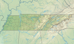
| Location | Shiloh, Hardin County, Tennessee & Corinth, Mississippi, US |
| Nearest city | Savannah, Tennessee |
| Coordinates | 35°08′12″N 88°20′26″W / 35.13667°N 88.34056°W |
| Area | 9,324 acres (37.73 km2)[1] |
| Established | December 27, 1894[2] |
| Visitors | 371,735 (in 2023) |
| Governing body | National Park Service |
| Website | Shiloh National Military Park |
| Shiloh National Battlefield | |
|---|---|
 | |
| Governing body | National Park Service |
Shiloh National Military Park preserves the American Civil War Shiloh and Corinth battlefields. The main section of the park is in the unincorporated community of Shiloh, about nine miles (14 km) south of Savannah, Tennessee, with additional areas located in the city of Corinth, Mississippi, 23 miles (37 km) southwest of Shiloh and the Parker's Crossroads Battlefield in the city of Parkers Crossroads, Tennessee. The Battle of Shiloh (April 6–7, 1862) began a six-month struggle for the key railroad junction at Corinth. Afterward, Union forces marched from Pittsburg Landing to take Corinth in a May siege, then withstood an October Confederate counter-attack.
The visitor center provides exhibitions, films and a self-guided auto-tour.
- ^ "Listing of acreage – December 31, 2020" (XLSX). Land Resource Division, National Park Service. Retrieved August 15, 2021. (National Park Service Acreage Reports)
- ^ "Park Anniversaries". Retrieved August 13, 2021.


