Back Taman Nasional Shuklaphanta BAN শুক্লাফাঁটা জাতীয় উদ্যান Bengali/Bangla Suklaphanta-Wildreservat German शुक्लाफाँट वन्यजन्तु आरक्ष DTY Parque nacional Shuklaphanta Spanish Réserve faunique de Shukla Phanta French Riserva naturale di Suklaphanta Italian शुक्लाफाँट वन्यजन्तु आरक्ष MAI ഷക്ലഫാന്ത ദേശീയോദ്യാനം Malayalam शुक्लाफाँट राष्ट्रिय निकुञ्ज Nepali
| Shuklaphanta National Park | |
|---|---|
| Nepali: शुक्लाफाँट राष्ट्रिय निकुञ्ज | |
 Rani Tal, a lake inside Shuklaphanta National Park | |
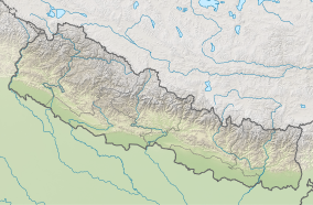
| Location | Nepal, Sudurpashchim Province |
| Nearest city | Bhimdatta |
| Coordinates | 28°50′24.72″N 80°13′44.40″E / 28.8402000°N 80.2290000°E |
| Area | 305 km2 (118 sq mi) |
| Established | 1976 as Wildlife Reserve; 2017 as National Park |
| Governing body | Department of National Parks and Wildlife Conservation (Nepal) |
| Website | shuklaphantanationalpark |
 | |
Shuklaphanta National Park is a national park in the Terai of the Far-Western Region, Nepal, covering 305 km2 (118 sq mi) of open grasslands, forests, riverbeds and wetlands at an elevation of 174 to 1,386 m (571 to 4,547 ft). It is bounded by the Mahakali river in the west and south. A small part extends north of the Mahendra Highway to create a wildlife corridor for seasonal migration of wildlife into the Sivalik Hills. It was gazetted in 1976 as Royal Shuklaphanta Wildlife Reserve and was enlarged to its present size in the late 1980s. A buffer zone of 243.5 km2 (94.0 sq mi) was added in 2004. It receives a mean annual rainfall of 1,579 mm (62.2 in) and harbours 700 floral, 456 bird, 56 reptile and 15 amphibian species.
