| Sonoma Coast State Park | |
|---|---|
 | |
 | |
| Location | Sonoma County, California |
| Nearest city | Jenner |
| Coordinates | 38°22′8.39″N 123°4′25.28″W / 38.3689972°N 123.0736889°W |
| Governing body | California Department of Parks and Recreation |

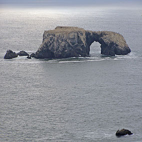
Sonoma Coast State Park is a State of California property in Sonoma County consisting of public access use on lands adjoining the Pacific Ocean. This extent of beach runs from a coastal point about 4 miles (6 km) north of Jenner and continues for approximately 17 miles (27 km) to the south to terminate at Bodega Head. The property lies along State Route 1 and consists of a number of named beaches including Arched Rock Beach, Gleason Beach and Goat Rock Beach. The ecosystem consists of alternating sandy beaches and rocky shoreline, with a marine terrace extending above the entire extent with an upland California coastal prairie habitat.
