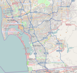
32°42′3″N 117°3′19″W / 32.70083°N 117.05528°W
Southeast San Diego | |
|---|---|
| Southeast San Diego | |
 Mural in Chicano Park, Southeast San Diego | |
| Nickname: "The Southeast" | |
| Coordinates: 32°42′03″N 117°03′19″W / 32.700833°N 117.055278°W | |
| Country | |
| State | |
| County | |
| City | |
| Area | |
• Total | 55 km2 (21.2 sq mi) |
| Population | |
• Total | 195,000 |
| • Density | 3,585/km2 (9,285/sq mi) |
Southeast San Diego refers to the southeastern portion of San Diego, including the neighborhoods south of State Route 94 (Martin Luther King Jr. Freeway) and east of downtown San Diego (but excluding South San Diego). Southeast San Diego has no official definition, but it may be considered coterminous with three official planning areas: Skyline-Paradise Hills, Chollas Valley,[5] and Southeastern.
Largely urbanized in the areas nearer downtown San Diego to the west[6] and characteristically hilly, with lower-density residential and semi-rural neighborhoods toward the east, Southeast San Diego is economically and ethnically diverse.
In 1992, Councilman George Stevens campaigned against any official usage of the name "Southeast San Diego," since the designation had long been viewed as shorthand for the community as being crime-ridden and impoverished. His campaign was successful and all official use of "Southeast San Diego" has been discontinued by the city.[7] Many residents and locals however, still refer to the area as "Southeast."
- ^ "92102 Zip Code Detailed Profile". Retrieved November 22, 2007.
- ^ "92113 Zip Code Detailed Profile". Retrieved November 22, 2007.
- ^ "92114 Zip Code Detailed Profile". Retrieved November 22, 2007.
- ^ "92139 Zip Code Detailed Profile". Retrieved November 22, 2007.
- ^ sandiego.org.
{{cite web}}: Missing or empty|title=(help); Missing or empty|url=(help) - ^ "Southeastern San Diego Community Profile". Retrieved November 17, 2007.
- ^ "George Stevens 1932–2006 11 years a councilman, always a fighter". Retrieved November 17, 2007.

