Back مقاطعة سانت جيمس (لويزيانا) Arabic St. James Parish, Louisiana BAR সেন্ট জেমস পারিশ, লুইসিয়ানা BPY St. James Parish (Louiziana) Breton Séng James Gông (Louisiana) CDO Сент-Джеймс (кӀошт, Луизиана) CE Saint James Parish (kondado sa Tinipong Bansa) CEB St. James Parish, Louisiana Welsh St. James Parish German Parroquia de St. James Spanish
St. James Parish | |
|---|---|
 Oak Alley Plantation Mansion. | |
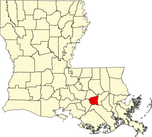
 Location within the U.S. state of Louisiana | |
 Louisiana's location within the U.S. | |
| Coordinates: 30°02′N 90°48′W / 30.03°N 90.8°W | |
| Country | |
| State | |
| Founded | March 31, 1807 |
| Named for | St. James |
| Seat | Convent |
| Largest town | Lutcher |
| Area | |
• Total | 258 sq mi (670 km2) |
| • Land | 242 sq mi (630 km2) |
| • Water | 16 sq mi (40 km2) 6.4% |
| Population (2020) | |
• Total | 20,192 |
| • Density | 78/sq mi (30/km2) |
| Time zone | UTC−6 (Central) |
| • Summer (DST) | UTC−5 (CDT) |
| Congressional district | 2nd |
| Website | www |
St. James Parish (French: Paroisse de Saint-Jacques) is a parish located in the U.S. state of Louisiana. The parish seat is Convent.[1] The parish was created in 1807.[2] St. James Parish is a part of the New Orleans–Metairie, Louisiana metropolitan statistical area, sitting between New Orleans and Baton Rouge on the Mississippi River. According to the 2020 United States census, the population was 20,192.[3]
- ^ "Find a County". National Association of Counties. Retrieved June 7, 2011.
- ^ "St. James Parish, Louisiana". Archived from the original on December 15, 1996. Retrieved March 6, 2018.
- ^ "QuickFacts: St. James Parish, Louisiana". U.S. Census Bureau.
