Back مقاطعة سانت جوزيف (إنديانا) Arabic St. Joseph County, Indiana BAR Сейнт Джоузеф (окръг, Индиана) Bulgarian সেন্ট যোসেফ কাউন্টি, ইন্ডিয়ানা BPY Séng Joseph Gông (Indiana) CDO Сент-Джозеф (гуо, Индиана) CE Saint Joseph County (kondado sa Tinipong Bansa, Indiana) CEB St. Joseph County, Indiana Welsh St. Joseph County (Indiana) German Kantono St. Joseph (Indianio) Esperanto
This article needs to be updated. (October 2024) |
Saint Joseph County | |
|---|---|
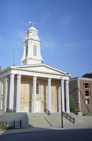
 Old St. Joseph County courthouse in South Bend, Indiana | |
 Location within the U.S. state of Indiana | |
 Indiana's location within the U.S. | |
| Coordinates: 41°37′N 86°17′W / 41.62°N 86.29°W | |
| Country | |
| State | |
| Founded | 1830 |
| Named for | St. Joseph River |
| Seat | South Bend |
| Largest city | South Bend |
| Area | |
• Total | 461.38 sq mi (1,195.0 km2) |
| • Land | 457.85 sq mi (1,185.8 km2) |
| • Water | 3.54 sq mi (9.2 km2) 0.77% |
| Population (2020) | |
• Total | 272,912 |
• Estimate (2023) | 272,848 |
| • Density | 590/sq mi (230/km2) |
| Time zone | UTC−5 (Eastern) |
| • Summer (DST) | UTC−4 (EDT) |
| Congressional district | 2nd |
| Website | www |
| |
St. Joseph County, colloquially called St. Joe County by residents, is a county located in the U.S. state of Indiana. As of the 2020 census, the population was 272,912,[1] making it the fifth-most populous county in Indiana. Formed in 1830, it was named for the St. Joseph River which flows through it to Lake Michigan. The county seat is South Bend.[2] St. Joseph County is part of the South Bend–Mishawaka, IN–MI "Michiana", Metropolitan Statistical Area.
- ^ "St. Joseph County, Indiana". United States Census Bureau. Retrieved June 7, 2023.
- ^ "Find a County". National Association of Counties. Retrieved June 7, 2011.

