Back مقاطعة سوليفان (إنديانا) Arabic Sullivan County, Indiana BAR Съливан (окръг, Индиана) Bulgarian সুল্লিবান কাউন্টি, ইন্ডিয়ানা BPY Sullivan Gông (Indiana) CDO Салливан (гуо, Индиана) CE Sullivan County (kondado sa Tinipong Bansa, Indiana) CEB Sullivan County, Indiana Welsh Sullivan County (Indiana) German Κομητεία Σάλιβαν (Ιντιάνα) Greek
39°05′N 87°25′W / 39.09°N 87.41°W
Sullivan County | |
|---|---|
 Sullivan County Courthouse | |
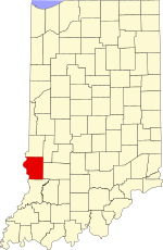
 Location within the U.S. state of Indiana | |
 Indiana's location within the U.S. | |
| Coordinates: 39°05′N 87°25′W / 39.09°N 87.41°W | |
| Country | |
| State | |
| Founded | January 15, 1817 (created) February 1817 (organized) |
| Named for | General Daniel Sullivan |
| Seat | Sullivan |
| Largest city | Sullivan |
| Area | |
• Total | 454.12 sq mi (1,176.2 km2) |
| • Land | 447.14 sq mi (1,158.1 km2) |
| • Water | 6.97 sq mi (18.1 km2) 1.53% |
| Population (2020) | |
• Total | 20,817 |
• Estimate (2023) | 20,757 |
| • Density | 46/sq mi (18/km2) |
| Time zone | UTC−5 (Eastern) |
| • Summer (DST) | UTC−4 (EDT) |
| Congressional district | 8th |
| Website | www |
| Indiana county number 77 | |
Sullivan County is a county in the U.S. state of Indiana, and determined by the US Census Bureau to include the mean center of U.S. population in 1940.[1] As of 2023, the population was estimated at 20,757.[2] The county seat (and the county's only incorporated city) is Sullivan.[3] Sullivan County is included in the Terre Haute, Indiana, metropolitan statistical area.
- ^ "Mean Center of Population for the United States: 1790 to 2000" (PDF). US Census Bureau. Archived from the original (PDF) on November 3, 2001. Retrieved September 17, 2011.
- ^ "Sullivan County QuickFacts". United States Census Bureau. Retrieved January 1, 2023.
- ^ "Find a County". National Association of Counties. Retrieved June 7, 2011.