Back مقاطعة سوليفان (نيو هامبشاير) Arabic Sullivan County, New Hampshire BAR Съливан (окръг, Ню Хампшър) Bulgarian সুল্লিভান কাউন্টি, নিউ হ্যাম্পশায়ার BPY Sullivan Gông (New Hampshire) CDO Салливан (гуо, Нью-Гэмпшир) CE Sullivan County (kondado sa Tinipong Bansa, New Hampshire) CEB Sullivan County (New Hampshire) Czech Sullivan County, New Hampshire Welsh Sullivan County (New Hampshire) German
Sullivan County | |
|---|---|
 Lempster Mountain Wind Power Project overlooking cemetery in East Lempster, NH | |
 Location within the U.S. state of New Hampshire | |
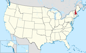
 New Hampshire's location within the U.S. | |
| Coordinates: 43°20′39″N 72°14′50″W / 43.344208°N 72.24733°W | |
| Country | |
| State | |
| Founded | 1827 |
| Named for | John Sullivan |
| Seat | Newport |
| Largest city | Claremont |
| Area | |
• Total | 552.1 sq mi (1,430 km2) |
| • Land | 537.5 sq mi (1,392 km2) |
| • Water | 14.6 sq mi (38 km2) 2.6% |
| Population (2020) | |
• Total | 43,063 |
| • Density | 80.1/sq mi (30.9/km2) |
| Time zone | UTC−5 (Eastern) |
| • Summer (DST) | UTC−4 (EDT) |
| Congressional district | 2nd |
| Website | sullivancountynh |
Sullivan County is a county in the U.S. state of New Hampshire. As of the 2020 census, the population was 43,063,[1] making it the second-least populous county in New Hampshire. Its county seat is Newport.[2]
Sullivan County is included in the Claremont-Lebanon, NH-VT Micropolitan Statistical Area.
- ^ "Census - Geography Profile: Sullivan County, New Hampshire". United States Census Bureau. Retrieved November 21, 2021.
- ^ "Find a County". National Association of Counties. Retrieved June 7, 2011.
