Back ቅየሳ Amharic مساحة (تخصص) Arabic Mərzçəkmə Azerbaijani सर्वेक्षण Bihari ভূমি জরিপ Bengali/Bangla Agrimensura Catalan ڕووپێوی CKB Zeměměřičství Czech Landmåling Danish Vermessung German
This article needs additional citations for verification. (June 2023) |


Surveying or land surveying is the technique, profession, art, and science of determining the terrestrial two-dimensional or three-dimensional positions of points and the distances and angles between them. These points are usually on the surface of the Earth, and they are often used to establish maps and boundaries for ownership, locations, such as the designated positions of structural components for construction or the surface location of subsurface features, or other purposes required by government or civil law, such as property sales.[1]
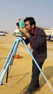
A professional in land surveying is called a land surveyor. Surveyors work with elements of geodesy, geometry, trigonometry, regression analysis, physics, engineering, metrology, programming languages, and the law. They use equipment, such as total stations, robotic total stations, theodolites, GNSS receivers, retroreflectors, 3D scanners, lidar sensors, radios, inclinometer, handheld tablets, optical and digital levels, subsurface locators, drones, GIS, and surveying software.
Surveying has been an element in the development of the human environment since the beginning of recorded history. It is used in the planning and execution of most forms of construction. It is also used in transportation, communications, mapping, and the definition of legal boundaries for land ownership. It is an important tool for research in many other scientific disciplines.
- ^ United States Department of the Interior, Bureau of Land Management Technical Bulletin (1973). Manual of Instructions for the Survey of the Public Lands of the United States 1973. Washington, DC: United States Government Printing Office. p. 1. ISBN 978-0910845601.