Back تافونا AZB Tāfuna CEB Tāfuna German Tafuna Spanish Tafuna Estonian تافونا Persian Տաֆունա Armenian Tafuna Italian Tafuna, Samoa Amerika Malay Tafuna NB
Tafuna, American Samoa | |
|---|---|
Village | |
| Tāfuna | |
 Tafuna Airport seen from A'oloau | |
| Coordinates: 14°20′09″S 170°43′12″W / 14.33583°S 170.72000°W | |
| Country | |
| Territory | |
| County | Tuālāuta |
| Government | |
| • Mayor | Sefe Tau’ese |
| Area | |
• Total | 2.53 sq mi (6.54 km2) |
| Population (2020) | |
• Total | 7,988[1] |
| • Density | 3,190.5/sq mi (1,231.9/km2) |
| ZIP code | 96799 |
 | |
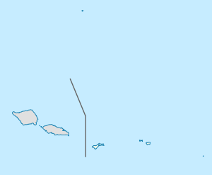
Tafuna (Samoan: Tāfuna) is a village in Tualauta County, Western District, American Samoa. It is the most populous village in American Samoa,[2] with a population of 7,988 according to the 2020 U.S. Census.[3]
Tafuna is the principal area for the development of housing and industry in American Samoa. It is one of the few places in American Samoa where the most freehold land is found.[4] Public utilities, the international airport, and light industry are based on the Tafuna Plain.[5] Tafuna's commercial strip is lined with businesses, government offices, recreational facilities, school institutions, service industries, and shops. It encompasses the constituent villages of Petesa, Faga'ima, Kokoland, and Ottoville.[6]
- ^ "Table 2. 2020 Census" (PDF). Census Bureau. Archived (PDF) from the original on 2022-12-07. Retrieved 2022-07-01.
- ^ "American Samoa census puts population at 55,500". RNZ. January 13, 2012. Archived from the original on June 24, 2020. Retrieved June 22, 2020.
- ^ "Table 2, 2020 Census" (PDF). Census Bureau. Archived (PDF) from the original on 7 December 2022. Retrieved 1 July 2022.
- ^ Leonard, Barry (2009). Minimum Wage in American Samoa 2007: Economic Report. DIANE Publishing. Pages 12-13. ISBN 978-1-4379-1425-2.
- ^ Hotta, Kenji and Ian M. Dutton (1995). Coastal Management in the Asia-Pacific Region: Issues and Approaches. Japan International Marine Science and Technology Federation. Page 362. ISBN 978-1-875855-09-4.
- ^ "ASG-FEMA pre-registration begins today for Tafuna— and subdivisions". www.samoanews.com. March 7, 2018. Archived from the original on June 25, 2020. Retrieved June 22, 2020.

