Back Taman Sari, Jakarta Barat BAN Taman Sari, Jakarta Kulon BEW Kecamatan Tamansari CEB Taman Sari, Jakarta Barat ID Tamansari, Jakarta Kulon JV Taman Sari, Jakarta Barat Malay Taman Sari (West-Jakarta) Dutch Taman Sari (Dżakarta Zachodnia) Polish Taman Sari, Jakarta Kulon Sundanese Kecamatan Tamansari Swedish
This article needs additional citations for verification. (July 2016) |
Taman Sari District | |
|---|---|
| Kecamatan Taman Sari | |
| Native transcription(s) | |
| • Javanese | ꦠꦩꦤ꧀ꦱꦫꦶ |
| • Sundanese | ᮒᮙᮔ᮪ᮞᮛᮤ |
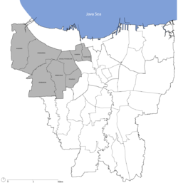
 Location of Taman Sari District in West Jakarta | |
 | |
| Country | |
| Province | |
| Seat | Jakarta |
| Government | |
| • Head of District officer | - |
| Area | |
• Total | 7.73 km2 (2.98 sq mi) |
| Time zone | UTC+7 (IST) |
| • Summer (DST) | UTC+7 (Western Indonesia Time) |
| Postcode | 110xxx |
| Vehicle registration plates | B |

Taman Sari is a district (kecamatan) of West Jakarta Administrative City, Indonesia. It is the smallest district of West Jakarta (4.37 km2). It is bounded by Central Jakarta to the south and to the east, and by Pademangan in North Jakarta to the north.
Taman Sari District contains the southeastern area of Jakarta Old Town, the area on the east side of Kali Besar Canal. The Old Town formed Batavia (the old name for Jakarta) during the 17th century. This historic area is in the Pinangsia Administrative Village, the northern part of the district.
- ^ "Luas Wilayah (km²), 2019-2022 – BPS Kota Administrasi Jakarta Barat" [Total Area (in km²), 2019-2022 – National Central Statistics Agency of Indonesi – West Jakarta City] (in Indonesian).


