Back تيزبور ARZ তেজপুৰ Assamese Тэзпур Byelorussian तेजपुर Bihari তেজপুর Bengali/Bangla তেজপুর BPY Tezpur CEB Tezpur Danish Tezpur German Tezpur Esperanto
This article has multiple issues. Please help improve it or discuss these issues on the talk page. (Learn how and when to remove these messages)
|
Tezpur | |
|---|---|
City | |
| Tezpur City | |
|
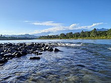
Agnigarh Hill (top), Mahabhairav Temple and Harihara War Sculpture (middle), Nameri National Park (bottom) | |
| Coordinates: 26°38′N 92°48′E / 26.63°N 92.8°E | |
| Country | |
| State | Assam |
| District | Sonitpur |
| Government | |
| • Type | Municipality |
| • Body | Tezpur Municipality Board |
| Area | |
• Total | 40 km2 (20 sq mi) |
| Elevation | 80 m (260 ft) |
| Population (2011)[1] | |
• Total | 102,505 |
| • Rank | 6th |
| • Density | 2,600/km2 (6,600/sq mi) |
| Languages | |
| • Official | Assamese |
| Time zone | UTC+5:30 (IST) |
| ISO 3166 code | IN-AS |
| Vehicle registration | AS-12 |
| Website | sonitpur |
Tezpur (Assamese: [tɛz.pʊɹ]) is a city in Sonitpur district, Assam state, India. Tezpur is located on the banks of the river Brahmaputra, 175 kilometres (109 mi) northeast of Guwahati, and is the largest of the north bank cities.[citation needed]
- ^ "Tezpur Metropolitan Urban Region Population 2011-2021 Census". Archived from the original on 5 April 2019. Retrieved 8 October 2018.


