Back Vuurland Afrikaans Feuerland ALS Fȳrland ANG أرض النار Arabic Tierra del Fueu AST Odlu Torpaq (arxipelaq) Azerbaijani Утлы Ер Bashkir Вогненная Зямля Byelorussian Вогненая Зямля BE-X-OLD Огнена земя Bulgarian
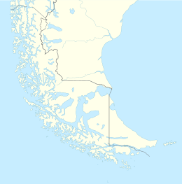
 Tierra del Fuego archipelago at the tip of South America | |
| Geography | |
|---|---|
| Location | Pacific Ocean, Atlantic Ocean |
| Major islands | Tierra del Fuego, Hoste, Navarino, Gordon, Wollastone, Noir, Staten, Hermite, Santa Inés, Clarence, Dawson, Capitán Aracena, Londonderry, Picton, Lennox, Nueva, Diego Ramírez, O'Brien, and Desolación Islands among many others |
| Highest point | Monte Shipton |
| Administration | |
| Region | |
| Provinces | Tierra del Fuego Province and Antártica Chilena |
| Communes | Cabo de Hornos, Antártica, Porvenir, Primavera, Timaukel |
| Province | |
| Demographics | |
| Population | ~201.000 (2022) |
| Ethnic groups | Argentines, Chileans, Selk'nams, Kawésqar, Yaghans |
Tierra del Fuego (/tiˈɛərə dɛl ˈfweɪɡoʊ/, Spanish: [ˈtjera ðel ˈfweɣo]; Spanish for "Land of Fire", rarely also Fireland in English) is an archipelago off the southernmost tip of the South American mainland, across the Strait of Magellan.
The archipelago consists of the main island, Isla Grande de Tierra del Fuego, with an area of 73,746 km2 (28,473 sq mi),[1] along with numerous smaller islands, including Cape Horn and Diego Ramírez Islands. Tierra del Fuego, including its many islands, is divided between Chile, which controls the western portion of the archipelago (roughly two-thirds), and Argentina, which controls the remaining eastern portion.[1] The southernmost extent of the archipelago, Cape Horn, lies just north of latitude 56°S.
The earliest known human settlement in Tierra del Fuego dates to approximately 8,000 BC.[2] Europeans first explored the islands during Ferdinand Magellan's expedition of 1520. Tierra del Fuego and similar namings stem from sightings of the many bonfires that the natives built along the coastline and possibly even in their canoes for the purpose of warmth and signaling.[3][4]
Settlement by those of European descent and the displacement of the native populations did not begin until the second half of the nineteenth century, at the height of the Patagonian sheep farming boom and of the local gold rush.[5] Today, petroleum extraction dominates economic activity in the north of Tierra del Fuego, while tourism, manufacturing, and Antarctic logistics are important in the south.
- ^ a b "Tierra del Fuego | Archipelago, Patagonia, Argentina & Chile | Britannica". www.britannica.com. Retrieved 24 January 2025.
- ^ Morello, Flavia; Borrero, Luis; Massone, Mauricio; Stern, Charles; García-Herbst, Arleen; McCulloch, Robert; Arroyo-Kalin, Manuel; Calás, Elisa; Torres, Jimena; Prieto, Alfredo; Martinez, Ismael; Bahamonde, Gabriel; Cárdenas, Pedro (1 March 2012). "Hunter-gatherers, biogeographic barriers and the development of human settlement in Tierra del Fuego". Antiquity. 86 (331): 71–87. doi:10.1017/S0003598X00062463. hdl:1893/3664. S2CID 161882222.
- ^ Australis (11 April 2017). "8 Facts You Never Knew About the Tierra del Fuego Archipelago". Patagonia and other adventure travel destinations. Retrieved 26 January 2025.
- ^ "In Search of Paradise Lost in Tierra del Fuego". Earth Island Journal. Retrieved 26 January 2025.
- ^ Iparraguirre, Sylvia (19 March 2024). Tierra del fuego: a biography of the end of the world. Photo Design Ediciones - Florian von der Fecht. p. 146. ISBN 978-987-99166-9-8. Archived from the original on 23 September 2023. Retrieved 1 March 2016.
