Back جبل توفوا ARZ Tofua Catalan Tofua Island CEB Tofua German Tofua Spanish توفوآ Persian Tofua French Tofua Galician Tofua Hungarian Tofua ID
| Tofua | |
|---|---|
 Tofua Island (lower left) and neighbouring Kao Island, Tonga, Pacific Ocean | |
| Highest point | |
| Elevation | 515 m (1,690 ft) |
| Prominence | 515 m (1,690 ft) |
| Listing | List of volcanoes in Tonga |
| Coordinates | 19°45′00″S 175°04′30″W / 19.75000°S 175.07500°W |
| Geography | |
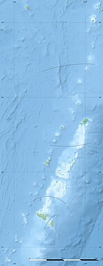
Tonga Islands, Tonga | |
| Geology | |
| Mountain type | Volcanic caldera |
| Last eruption | 2022 (Ongoing)[1] |

Tofua is a volcanic island in Tonga. Located in the Haʻapai island group, it is a steep-sided composite cone with a summit caldera. It is part of the highly active Kermadec-Tonga subduction zone and its associated volcanic arc, which extends from New Zealand north-northeast to Fiji, and is formed by the subduction of the Pacific Plate under the Indo-Australian Plate.[2] It lies about 100 km (62 mi) above a very active seismic zone.[3] It is connected to the nearby island of Kao by a submarine ridge.[4]
The island is a national park.
- ^ "Tofua: Eruptive History". Global Volcanism Program. Smithsonian Institution. Retrieved 21 February 2022.
- ^ Caulfield, J. T.; Turner, S. P.; Smith, I. E. M.; Cooper, L. B.; Jenner, G. A. (2012). "Magma Evolution in the Primitive, Intra-oceanic Tonga Arc: Petrogenesis of Basaltic Andesites at Tofua Volcano". Journal of Petrology. 53 (6): 1197–1230. doi:10.1093/petrology/egs013. Retrieved 22 January 2022.
- ^ Ewart, A.; Bryan, W.B.; and Gill, J.B. "Mineralogy and Geochemistry of the Younger Volcanic Islands of Tonga, S.W. Pacific." Journal of Petrology. 14:3 (1973). doi:10.1093/petrology/14.3.429
- ^ Cite error: The named reference
Bauer1970was invoked but never defined (see the help page).
