Back Transalaigebiag BAR Заалайскі хрыбет Byelorussian Заалайски хребет Bulgarian Zaalayskiy Khrebet CEB Zaalajský hřbet Czech Transalaigebirge German Taga-Alai Estonian رشتهکوه ماورا آلای Persian Trans-Alai Finnish Chaînon Trans-Alaï French
| Trans-Alay Range | |
|---|---|
| Tajik: қаторкӯҳи Паси Олой Kyrgyz: Чоң Алай кырка тоосу Russian: Заалайский хребет | |
 Trans-Alay Range and Alay Valley | |
| Highest point | |
| Peak | Ibn Sina/Lenin Peak |
| Elevation | 7,134 m (23,406 ft) |
| Coordinates | 39°20′00″N 72°55′00″E / 39.3333°N 72.9167°E |
| Dimensions | |
| Length | 250 km (160 mi) E-W |
| Width | 40 km (25 mi) N-S |
| Naming | |
| Language of name | en |
| Geography | |
| Countries | Kyrgyzstan, Tajikistan |
| Region(s) | Osh Province, Gorno-Badakshan |
| Geology | |
| Rock age(s) | Paleozoic and Mesozoic |
| Rock type(s) | Limestone and schist |
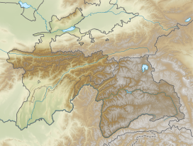
The Trans-Alay or Trans-Alai Range (Kyrgyz: Чоң Алай кырка тоосу, Chong Alay kyrka toosu; Tajik: қаторкӯҳи Паси Олой, qatorkŭhi Pasi Oloy, or қаторкӯҳи Каюмарс, qatorkŭhi Kayumars; Russian: Заалайский хребет, Zaalaisky Khrebet) is the northernmost range of the Pamir Mountain System. Following the collapse of the Soviet Union, the range has been divided between Tajikistan and Kyrgyzstan.
