Back Vatulele Island CEB Vatulele Czech Vatulele Finnish Vatulele Fiji Vatulele HIF Vatulele Dutch Ватулеле Russian Vatulele Swedish 瓦圖萊萊島 Chinese
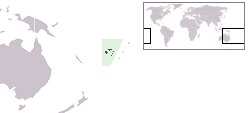
 Vatulele is located between Viti Levu and Kandavu islands | |
 | |
| Geography | |
|---|---|
| Location | Pacific Ocean |
| Coordinates | 18°32′30″S 177°37′40″E / 18.54167°S 177.62778°E |
| Archipelago | Viti Levu Group |
| Area | 32 km2 (12 sq mi) |
| Length | 13 km (8.1 mi) |
| Width | 3 km (1.9 mi) |
| Highest elevation | 320 m (1050 ft) |
| Administration | |
Fiji | |
| Division | Western Division |
| Largest settlement | Ekubo |

Vatulele (pronounced [βatuˈlele]) is a coral and volcanic island 32 kilometres (20 miles) south of Viti Levu, Fiji's largest island.
There are four villages on the island: Lomanikaya, Ekubo, Taunovo and Bouwaqa. Economic activities include coconut and taro farming, fishing and selling of Fijian hand printed tapa. Vatulele is known for its legend of the red prawns and petroglyphs. The island has a chiefly title known as the Vunisa Levu and is regarded as one of the independent islands in Fiji.