Back حى فيزيانجارام ARZ विजयनगरम जिला Bihari বিজয়নগরম জেলা Bengali/Bangla Vizianagaram District CEB Vizianagaram (distrikt) Danish Vizianagaram (Distrikt) German Βιζιαναγκάραμ νομός Greek Distrito de Vizianagaram Spanish Vizianagaram barrutia Basque بخش ویزیانا گرام Persian
Vizianagaram district | |
|---|---|
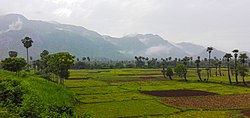
Clockwise from top-left: Vizianagaram Fort gate, Jayathi Kalinga Temples, Bodhikonda Jain caves at Ramateertham, Eastern Ghats near Sontivanipalem village, Dibbeshwara Temple | |
 Vizianagaram district in Andhra Pradesh | |
 Interactive map outlining district | |
| Country | |
| State | |
| Region | Uttarandhra |
| Headquarters | Vizianagaram |
| Mandals | 28[1] |
| Government | |
| • District collector | Dr. B. R. Ambedkar [2] |
| • Lok Sabha constituencies | Vizianagaram, Vishakapatnam |
| • Assembly constituencies | 07 |
| Area | |
• Total | 4,122 km2 (1,592 sq mi) |
| Population (2011)[3] | |
• Total | 1,930,811 |
| • Density | 470/km2 (1,200/sq mi) |
| • Urban | 429,764 |
| Demographics | |
| • Literacy | 59.49% |
| • Sex ratio | 1016 |
| PIN | 535XXX |
| Vehicle registration | AP-35 (former) AP–39 (from 30 January 2019)[4] |
| Major highways | NH-16, NH- 26, NH-516E |
| Coordinates | 18°12′N 83°24′E / 18.200°N 83.400°E |
| GDP(2022-23) | ₹33,079 crore (US$3.8 billion)[5] |
| Website | vizianagaram |
Vizianagaram district is one of the six districts in the Uttarandhra region of the Indian state of Andhra Pradesh with its headquarters located at Vizianagaram.[6][7] The district was once the part of ancient Kalinga.Saripilli Dibbilingeswara temple, Jayathi Mallikarjuna Temple are the finest examples of ancient Eastern Ganga Dynasty built monuments in the district.[8] The district is bounded on the east by the district of Srikakulam, north by Parvathipuram Manyam south by Visakhapatnam, Anakapalli, southeast by the Bay of Bengal, and west by Alluri Sitharama Raju district. It was formed on 1 June 1979, with some parts carved from the neighbouring districts of Srikakulam and Visakhapatnam.[9] The district is named after the princely state of Vizianagaram (Vijaya means victory and Nagaram means city in Telugu). In 2011, it was the least populous district in Andhra Pradesh.[10]
Vizianagaram district was formed on 1 June 1979,[a] with some parts carved from the neighbouring districts of Srikakulam and Visakhapatnam. The Taluks of Vizianagaram, Gajapathinagaram, Srungavarapukota and a portion of Bheemunipatnam Taluk were transferred from the Visakhapatnam District. The Salur, Bobbili, Parvathipuram and Cheepurupalli Taluks from Srikakulam district were transferred to the new district.
- ^ "District – Guntur". Andhra Pradesh Online Portal. Archived from the original on 28 April 2015. Retrieved 23 August 2014.
- ^ https://vizianagaram.ap.gov.in/
- ^ "District Census Hand Book – Vizianagaram" (PDF). Census of India. Registrar General and Census Commissioner of India.
- ^ "New 'AP 39' code to register vehicles in Andhra Pradesh launched". The New Indian Express. Vijayawada. 31 January 2019. Archived from the original on 28 July 2019. Retrieved 9 June 2019.
- ^ https://des.ap.gov.in/MainPage.do?mode=menuBind&tabname=publications
- ^ "Srikakulam | Andhra Pradesh | DISTRICTS OF INDIA". districts.nic.in. Retrieved 11 May 2019.
- ^ "Population of AP districts(2011)" (PDF). ap.gov.in. p. 14. Archived from the original (PDF) on 12 November 2013. Retrieved 25 May 2014.
- ^ Donaldson, Thomas E. (1985). "No 4 - Temples of the 10th and 11th centuries of Interior Orissa". Hindu Temple art of Orissa. Vol. 1 Part= 1. Leiden, The Netherlands: Leiden E.J Brill. pp. 254–256.
- ^ Law, Gwillim (25 September 2011). "Districts of India". Statoids. Retrieved 11 October 2011.
- ^ "District Census 2011". Census2011.co.in. 2011. Retrieved 30 September 2011.
Cite error: There are <ref group=lower-alpha> tags or {{efn}} templates on this page, but the references will not show without a {{reflist|group=lower-alpha}} template or {{notelist}} template (see the help page).


