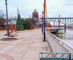
| Volunteer Landing | |
|---|---|
 | |
 | |
| Type | Public park, riverwalk |
| Location | 300 Neyland Drive, Knoxville, Tennessee |
| Coordinates | 35°57′31″N 83°55′01″W / 35.958733°N 83.916817°W |
| Created | 1997 |
| Owned by | City of Knoxville |
| Operated by | Knoxville Public Building Authority |
| Open | Dawn to dusk unless posted otherwise |
| Public transit access | KAT 10, 11, 17 |
| Website | Official website |
Volunteer Landing is a public park and riverwalk along the Tennessee River in Knoxville, Tennessee.[1][2] It is below the Gay Street Bridge.[1]
- ^ a b Huso, D. (2010). Moon Blue Ridge & Smoky Mountains. Moon Blue Ridge and Smoky Mountains. Avalon Publishing. p. 276. ISBN 978-1-59880-532-1. Retrieved 2020-07-24.
- ^ Molloy, J. (2011). Five-Star Trails: Knoxville: Your Guide to the Area's Most Beautiful Hikes. Five-Star Trails. Menasha Ridge Press. p. 33. ISBN 978-0-89732-922-4. Retrieved 2020-07-24.
