Back وارزاو، نیویورک AZB Ворсо (Нью-Йорк) CE Warsaw (kapital sa kondado sa Tinipong Bansa, New York) CEB Warsaw, Efrog Newydd Welsh Warsaw (New York) German Warsaw (Nueva York) Spanish Warsaw (New York) Basque Warsaw (ville, New York) French Warsaw, New York HT Warsaw (New York) Italian
Warsaw, New York | |
|---|---|
 | |
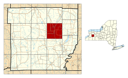
 Location within Wyoming County and New York | |
| Coordinates: 42°44′24″N 78°07′59″W / 42.74000°N 78.13306°W | |
| Country | United States |
| State | New York |
| County | Wyoming County |
| Founded | 1804 |
| Area | |
• Total | 35.47 sq mi (91.86 km2) |
| • Land | 35.42 sq mi (91.73 km2) |
| • Water | 0.05 sq mi (0.13 km2) 0.14% |
| Elevation | 1,020 ft (310 m) |
| Population | |
• Total | 5,316 |
| • Density | 150.10/sq mi (57.95/km2) |
| Time zone | UTC-5 (EST) |
| • Summer (DST) | UTC-4 (EDT) |
| ZIP code | 14569 |
| Area code | 585 |
| FIPS code | 36-121-78344 |
| GNIS feature ID | 0968827[3] |


Warsaw is a town in Wyoming County, in the U.S. state of New York. The population was 5,316 at the 2020 census.[2] It is located approximately 37 miles east southeast of Buffalo and approximately 37 miles southwest of Rochester. The town may have been named after Warsaw, Poland.
The Town of Warsaw is centrally located in the county and contains a village, also called Warsaw. The village is the county seat of Wyoming County.
- ^ "2020 U.S. Gazetteer Files". United States Census Bureau. Retrieved March 9, 2024.
- ^ a b "Profile of General Population and Housing Characteristics: 2020 Demographic Profile Data (DP-1): Warsaw town, Wyoming County, New York". United States Census Bureau. Retrieved March 9, 2024.
- ^ U.S. Geological Survey Geographic Names Information System: Warsaw, New York