Back مقاطعة واشنطن (ميزوري) Arabic واشينطون كاونتى (ميزورى) ARZ Washington County, Missouri BAR Вашингтон (окръг, Мисури) Bulgarian ৱাশিংটন কাউন্টি, মিসৌরি BPY Washington Gông (Missouri) CDO Вашингтон (гуо, Миссури) CE Washington County (kondado sa Tinipong Bansa, Missouri) CEB Washington County, Missouri Welsh Washington County (Missouri) German
Washington County | |
|---|---|
 The Washington County Courthouse in Potosi | |
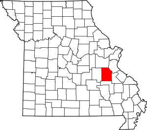
 Location within the U.S. state of Missouri | |
 Missouri's location within the U.S. | |
| Coordinates: 37°58′N 90°53′W / 37.97°N 90.88°W | |
| Country | |
| State | |
| Founded | August 21, 1813 |
| Named for | President George Washington |
| Seat | Potosi |
| Largest city | Potosi |
| Area | |
• Total | 762 sq mi (1,970 km2) |
| • Land | 760 sq mi (2,000 km2) |
| • Water | 2.6 sq mi (7 km2) 0.3% |
| Population (2020) | |
• Total | 23,514 |
| • Density | 31/sq mi (12/km2) |
| Time zone | UTC−6 (Central) |
| • Summer (DST) | UTC−5 (CDT) |
| Congressional district | 8th |
| Website | www |
Washington County is a county located in the southeastern part of the U.S. state of Missouri. As of the 2020 United States census, the population was 23,514.[1] The county seat and largest city is Potosi.[2] The county was officially organized on August 21, 1813, and was named in honor of George Washington, the first President of the United States.[3]
- ^ "Explore Census Data".
- ^ "Find a County". National Association of Counties. Retrieved June 7, 2011.
- ^ Eaton, David Wolfe (1918). How Missouri Counties, Towns and Streams Were Named. The State Historical Society of Missouri. p. 370.