Back وزتون، ماساچوست AZB Weston (Massachusetts) Catalan Вестон (Массачусетс) CE Weston (lungsod sa Tinipong Bansa, Massachusetts) CEB Weston, Massachusetts Welsh Weston (Massachusetts) German Weston (Massachusetts) Spanish Weston (Massachusetts) Basque وستون، ماساچوست Persian Weston (Massachusetts) French
This article's use of external links may not follow Wikipedia's policies or guidelines. (November 2024) |
Weston, Massachusetts | |
|---|---|
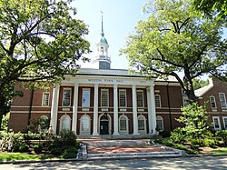
 Town Hall | |
 Location in Middlesex County in Massachusetts | |
| Coordinates: 42°22′00″N 71°18′11″W / 42.36667°N 71.30306°W | |
| Country | United States |
| State | Massachusetts |
| County | Middlesex |
| Settled | 1642 |
| Incorporated | 1713 |
| Area | |
• Total | 17.3 sq mi (44.9 km2) |
| • Land | 17.0 sq mi (44.1 km2) |
| • Water | 0.3 sq mi (0.8 km2) |
| Elevation | 180 ft (55 m) |
| Population (2020) | |
• Total | 11,851 |
| • Density | 690/sq mi (260/km2) |
| Time zone | UTC-5 (Eastern) |
| • Summer (DST) | UTC-4 (Eastern) |
| ZIP Code | 02493 |
| Area code | 781 / 339 |
| FIPS code | 25-77255 |
| GNIS feature ID | 0618245 |
| Website | www |
Weston is an affluent town in Middlesex County, Massachusetts, United States, located approximately 15 miles (24 km) west of Boston. At the time of the 2020 United States Census, the population of Weston was 11,851.[1]
Weston was incorporated in 1713, and protection of the town's historic resources is driven by the Weston Historical Commission[2] and Weston Historical Society.[3] The town has one Local Historic District, 10 National Register Districts, 26 Historic Areas, and seven houses individually listed on the National Register of Historic Places.[4]
Weston's predominance as a residential community is reflected in its population density, which is among the lowest of Boston's suburbs near or within Route 128.[5] More than 2,000 acres, or 18 percent of the town's total acreage, have been preserved as parks, fields, wetlands, and forests, with 90 miles of trails for hiking, horseback riding, and cross-country skiing.[6][7] Thirty-seven scenic roads, as defined by Massachusetts law,[8] maintain the town's aesthetic value and historical significance, affording Weston a semi-rural ambiance.[9]
- ^ "U.S. Census Bureau QuickFacts: United States". Retrieved September 16, 2021.
- ^ "Historical Commission". Retrieved September 26, 2021.
- ^ "About Weston's History". Retrieved September 26, 2021.
- ^ "Town of Weston, National Register Districts".
- ^ "Boston.com, Snapshot: Population Density, 2011".
- ^ "Weston Forest and Trail Association, Weston Trail Map".
- ^ "2017 Weston Open Space and Recreation Plan".
- ^ "General Laws of the Commonwealth of Massachusetts, Part I, Title VII, Chapter 40, Section 15C".
- ^ "Town of Weston, Scenic Roads".


