Back Уайт Сандс Bulgarian White Sands Missile Range Czech White Sands Missile Range Danish White Sands Missile Range German Polígono de Misiles de White Sands Spanish حوزه موشکی وایت سندز Persian White Sands Missile Range Finnish Polygone d'essais de missile de White Sands French מטווח הטילים וייט סנדס HE White Sands Rakétakísérleti Telep Hungarian
New Mexico Joint Guided Missile Test Range (1947) White Sands Proving Ground (1945) Alamogordo Bombing and Gunnery Range (1941)[2] | |
|---|---|
| Part of United States Army Test and Evaluation Command | |
| Located in the San Andres Mountains, the Oscura Mountains, the San Augustin Mountains, the Tularosa Basin, and the Chupadera Mesa in New Mexico | |
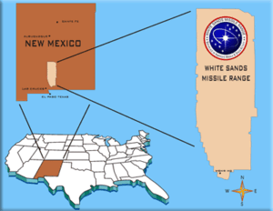
 Most of the northern Tularosa Basin (blue) is used for the WSMR (area within dashed perimeter), which encloses numerous areas that are not military land (e.g., the NPS's White Sands National Park), as well as United States Air Force facilities. | |
 WSMR location | |
| Coordinates | 32°20′08″N 106°24′21″W / 32.33556°N 106.40583°W[3] Condron Army Airfield near the southernmost WSMR point |
| Site information | |
| Controlled by | United States Army |
| Website | www |
| Site history | |
| Built | 1948-07-09 cantonment completed[4] 1957-02: Launch Complex 37 completed |
| Built by | Ordnance Corps[4] |
| Garrison information | |
| Current commander | BG Eric D. Little (2021–present)[5] |
| Past commanders |
|
White Sands Missile Range (WSMR) is a United States Army military testing area and firing range located in the US state of New Mexico. The range was originally established in 1941 as the Alamogordo Bombing and Gunnery Range, where the Trinity test site lay at the northern end of the Range, in Socorro County near the towns of Carrizozo and San Antonio. It then became the White Sands Proving Ground on 9 July 1945.
White Sands National Park founded in the 1930s is located within the range.
- ^ White Sands Administrative History (Report). National Park Service. Retrieved 26 November 2022.
- ^ Cite error: The named reference
WSAH4was invoked but never defined (see the help page). - ^ "Condron Army Airfield (2444053)". Geographic Names Information System. United States Geological Survey, United States Department of the Interior. Retrieved 28 May 2014. (Doña Ana county—entered in the GNIS on 20 March 2011)
- ^ a b Cite error: The named reference
AuthorTBDwas invoked but never defined (see the help page). - ^ "Leadership White Sands Missile Range". U.S. Army. Retrieved 26 November 2022.
- ^ "LTG Gwen Bingham". Association of the United States Army. 28 March 2017. Retrieved 26 November 2022.