Back Wiehengebirge CEB Wiehengebirge Danish Wiehengebirge German Wiehengebirge Spanish Wiehen Estonian Wiehengebirge Basque Wiehengebirge French Wiehengebergte Dutch Wiehengebirge NB Wiehengebirge Portuguese
| Wiehen Hills (Wiehengebirge) | |
|---|---|
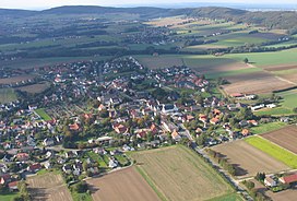
 The Wiehen Hills near Schnathorst, seen from the southeast | |
| Highest point | |
| Peak | Heidbrink |
| Elevation | 320 m (1,050 ft) |
| Dimensions | |
| Length | 70 km (43 mi) |
| Geography | |
| State | Lower Saxony/North Rhine-Westphalia |
| Range coordinates | 52°17′42″N 8°38′12″E / 52.29500°N 8.63667°E |
| Parent range | Lower Saxon Hills |

The Wiehen Hills[1] (German: Wiehengebirge, pronounced [ˈviːənɡəˌbɪʁɡə] ⓘ, also locally, just Wiehen) are a hill range in North Rhine-Westphalia and Lower Saxony in Germany. The hills run from west to east like a long finger away from the main upland area of the Lower Saxon Hills, beginning at the Weser River near Minden and terminating in the vicinity of Osnabrück. It is the northernmost of the German Central Upland ranges extending into the Northern Lowlands. Their highest hill is the Heidbrink near Lübbecke with an altitude of 320 metres (1,050 ft).


- ^ Elkins, T.H. (1972). Germany (3rd ed.). London: Chatto & Windus, 1972. ASIN B0011Z9KJA.
