| William O'Brien State Park | |
|---|---|
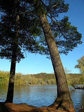
 The St. Croix River at William O'Brien State Park | |
| Location | Washington, Minnesota, United States |
| Coordinates | 45°13′9″N 92°45′57″W / 45.21917°N 92.76583°W |
| Area | 1,520 acres (6.2 km2) |
| Elevation | 801 ft (244 m)[1] |
| Established | 1947 |
| Governing body | Minnesota Department of Natural Resources |
William O'Brien State Park is a 1,520-acre (6.2 km2) state park of Minnesota, USA, along the St. Croix River. Its hiking trails traverse rolling glacial moraine, riparian zones, restored oak savanna, wooded areas and bogs. It is a popular place for birdwatching, picnics, camping, cross-country skiing, canoeing, fishing, and other typical outdoor recreational activities.
The park is located approximately two miles north of the town of Marine on St. Croix, Minnesota.
- ^ "William O'Brien State Park". Geographic Names Information System. United States Geological Survey. January 11, 1980. Retrieved February 25, 2011.


